Map Shows States With Highest Risk of Flu
Summary
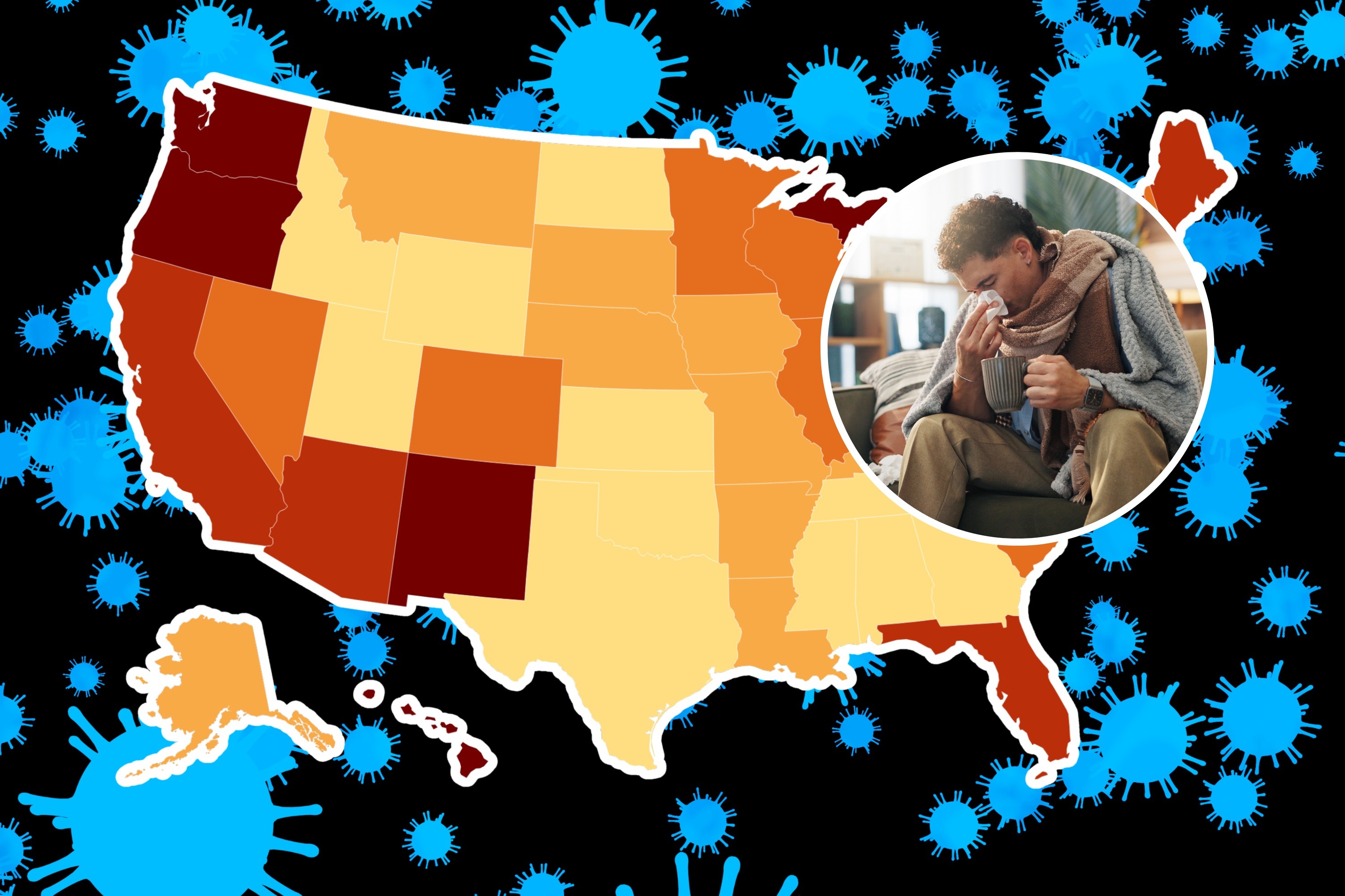
Researchers at Washington University in St. Louis have created a map showing which U.S. states are most vulnerable to the flu. The study used a range of factors like demographics, healthcare access, and economic conditions to assess flu risk. This can help policymakers develop strategies to prevent flu outbreaks.Key Facts
- Researchers studied 39 socioeconomic factors to assess flu vulnerability in U.S. states.
- The study inspired by CDC's natural disaster risk metrics included factors like insurance coverage and elderly populations.
- The map shows that 11 states, including Texas and Georgia, have very low flu vulnerability.
- Other states, including California and New York, show high or very high vulnerability to the flu.
- The map aims to help policymakers target flu prevention efforts in high-risk areas.
- High population density and mobility make places like Washington, D.C. more vulnerable.
- Certain states have increased risk due to demographics like elderly and uninsured populations.
Read the Full Article
This is a fact-based summary from The Actual News. Click below to read the complete story directly from the original source.