GPS jamming: The invisible battle in the Middle East
Summary
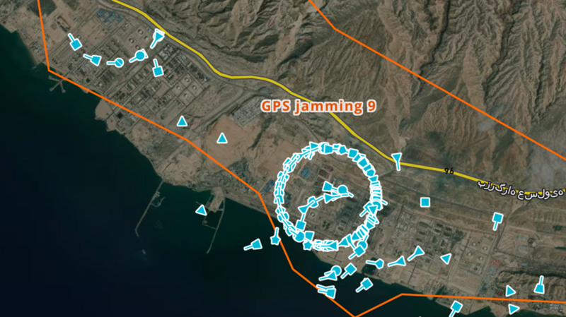
GPS jamming is causing disruptions for ships near the Iranian coast, making their locations appear incorrectly on navigation systems. This interference affects safe navigation and has been observed in various conflict areas, including the Strait of Hormuz and recently, the Middle East.Key Facts
- GPS jamming is causing ships near Iran to appear on land or in incorrect positions.
- The interference impacts ships' Automatic Identification Systems (AIS), which help avoid collisions.
- Such jamming has been seen before, including during past conflicts between Israel and Iran.
- Ships use AIS to help navigate safely, especially given their large size and slow response times.
- Iran is suspected of using GPS jamming, potentially with technology from Russia or China.
- The US military might also use jamming to protect their forces in the region from drones and guided weapons.
- GPS jamming can lead to increased risks of collisions at sea, particularly at night or in poor visibility.
Read the Full Article
This is a fact-based summary from The Actual News. Click below to read the complete story directly from the original source.