Map Shows Wildfire Risks Nationwide as Homes Destroyed
Summary
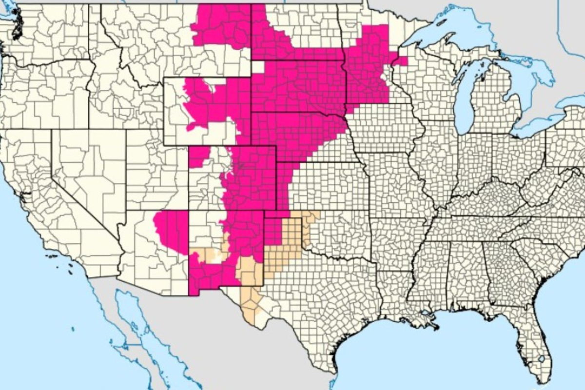
A new federal and state map shows a high risk of wildfires across many parts of the United States, especially from the Southeast to the Plains. Dry conditions, drought, and wind have already caused fast-moving fires in Georgia and Florida, destroying homes and forcing people to evacuate.Key Facts
- Wildfires have already destroyed nearly 50 homes in Georgia and Florida.
- More than 11 million people across the Intermountain West, Rockies, and Plains face "red flag" warnings, which mean high fire danger.
- Much of the Southeast is experiencing moderate to extreme drought, making plants and trees very dry and easy to burn.
- Smoke from these fires has affected air quality in cities like Atlanta, Savannah, and Jacksonville.
- In Brantley County, Georgia, a fire grew from 700 acres to over 5,000 acres in a few hours.
- Emergency teams have had to evacuate residents quickly, including removing some from their porches.
- Florida has been in drought for 18 months, and firefighting resources are pre-positioned across the state.
- Experts predict that between 5.5 and 8 million acres could burn nationwide in 2026, with the Northwest and Rocky Mountain regions at the highest risk.
Read the Full Article
This is a fact-based summary from The Actual News. Click below to read the complete story directly from the original source.