US Weather Maps Show States Facing Snow, Thunderstorms
Summary
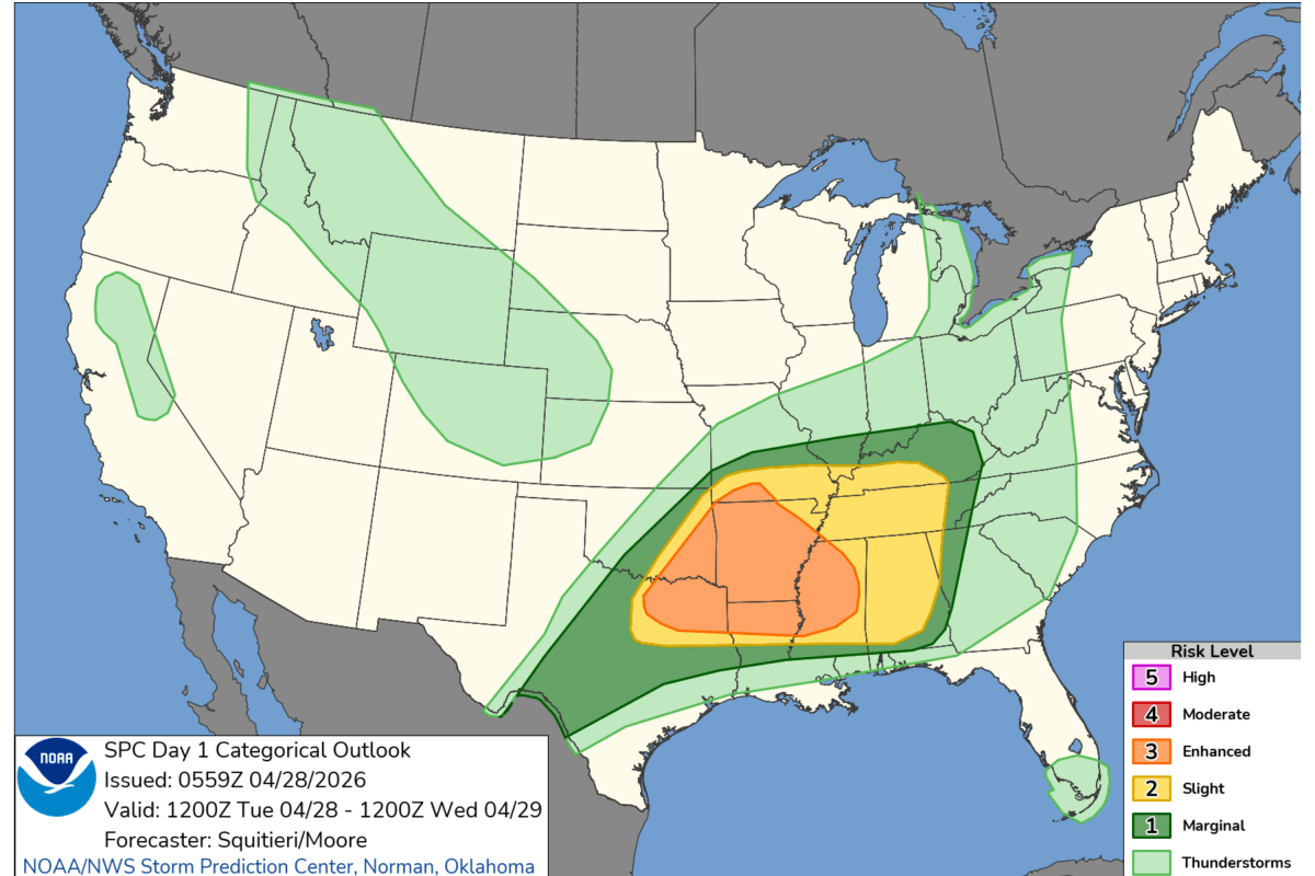
Parts of the United States are expecting severe thunderstorms, possible tornadoes, and heavy snow through Tuesday. The National Weather Service warns these storms could cause damage and disrupt travel in southern, midwestern, and western states.Key Facts
- Severe thunderstorms and possible tornadoes are expected in north Texas, east Texas, Arkansas, southeast Missouri, western Kentucky, Tennessee, and northern Mississippi.
- The highest risk area stretches from the Lower Mississippi Valley through the Tennessee and Ohio Valleys.
- Conditions causing storms include warm, humid air near the ground meeting cooler air higher up, which makes the atmosphere unstable.
- Storms may bring damaging wind gusts up to 60 mph and large hail up to one inch in size.
- Tornado watches remain in effect for parts of eastern Arkansas and Tennessee.
- The storms are moving quickly east at about 50 mph, increasing the risk of sudden damage.
- Residents are advised to monitor multiple weather alert sources and seek shelter in an interior, low-level room if a tornado warning is issued.
- There are ongoing severe thunderstorm warnings for parts of the mid-South, including Memphis and Nashville regions.
Read the Full Article
This is a fact-based summary from The Actual News. Click below to read the complete story directly from the original source.