Satellite Images Reveal Destruction of Georgia Wildfires
Summary
Two large wildfires have burned more than 50,000 acres in southern Georgia due to dry weather, leftover storm debris, and dry winds. Firefighters are working to control the fires, which have destroyed over 120 homes, the most in the state’s history.Key Facts
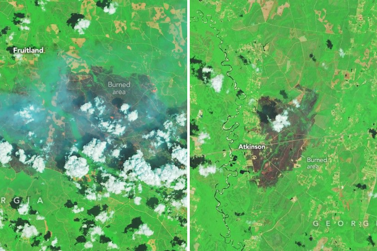
- The Pineland Road Fire and Highway 82 Fire started in April and have burned parts of Brantley and Clinch counties.
- NASA satellites show large burn areas and ongoing fire fronts.
- An extreme drought and debris from a 2024 hurricane made the fires spread faster.
- Both fires were caused by human activity: welding sparks and a balloon hitting power lines.
- As of late April, one fire was 23% contained and the other 32% contained.
- More than 120 homes were destroyed, a record loss for Georgia wildfires.
- Eight new small fires also started recently, burning a few more acres.
- Emergency groups gave $50,000 total in aid, respirators, and medical supplies to help affected communities.
Read the Full Article
This is a fact-based summary from The Actual News. Click below to read the complete story directly from the original source.