Florida Tornado Threat Map Shows Where Dangerous Storms Most Likely to Hit
Summary
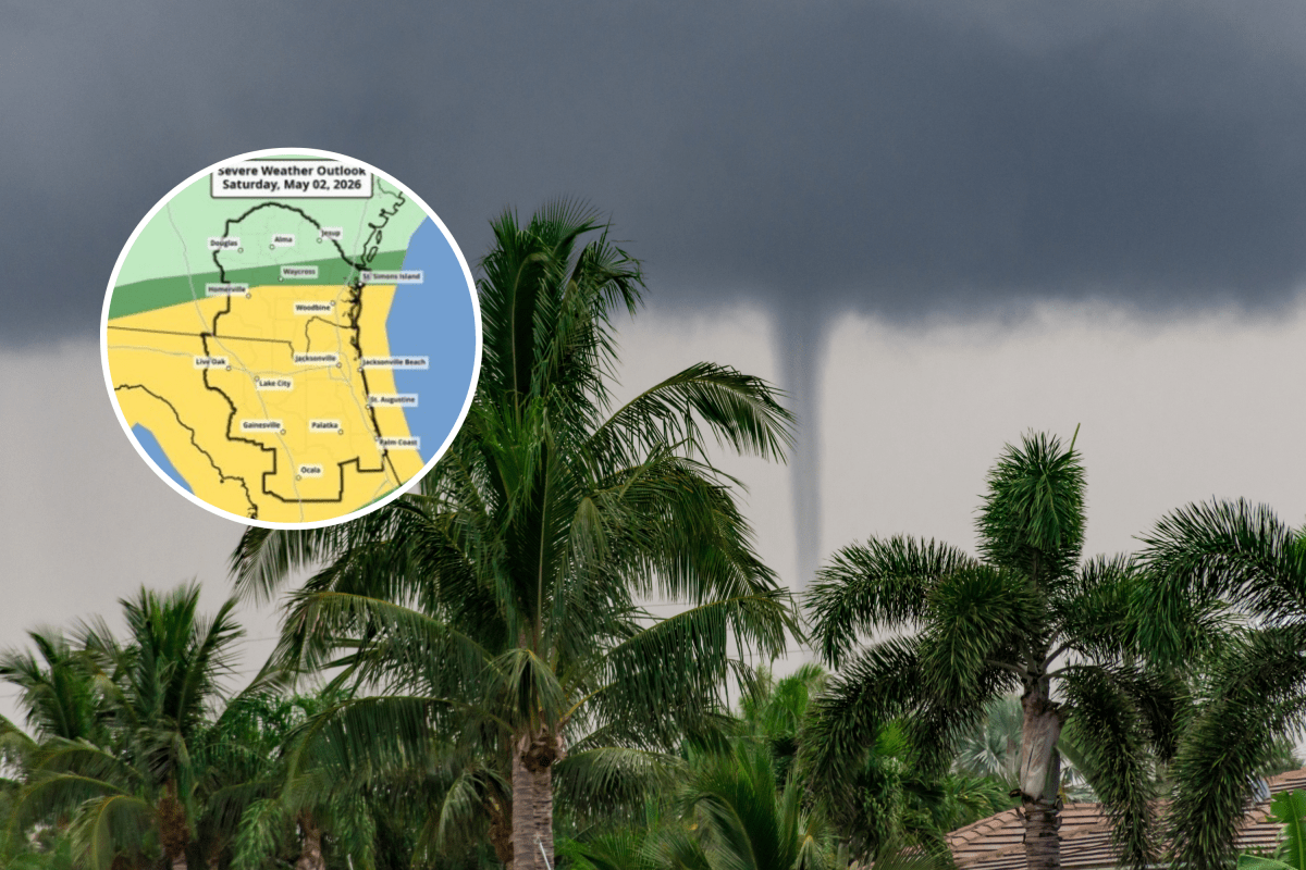
A strong line of thunderstorms is moving across Florida, bringing risks of tornadoes, heavy rain, and damaging winds, especially in northern and central parts of the state. While the rainfall may help reduce wildfire dangers temporarily, it is unlikely to end the ongoing severe drought affecting the area.Key Facts
- Severe thunderstorms are expected to hit northern and central Florida with possible tornadoes and strong wind gusts.
- The storm system is moving eastward and is caused by a low-pressure area meeting warm, moist air.
- Parts of Florida are experiencing extreme drought and high wildfire risks due to low rainfall and dry conditions.
- Rainfall from the storm could help lower wildfire threats but will not fully end the drought.
- Tornadoes in Florida happen on average 46 times per year, often less intense but still dangerous.
- Forecasters warn of possible flooding where heavy rains hit dry ground that absorbs water slowly.
- Emergency officials advise people to stay alert and have multiple ways to get weather warnings.
- The main severe storm hazards include damaging winds, isolated tornadoes, hail, and lightning.
Read the Full Article
This is a fact-based summary from The Actual News. Click below to read the complete story directly from the original source.