Erin rapidly intensifies to category five hurricane
Summary
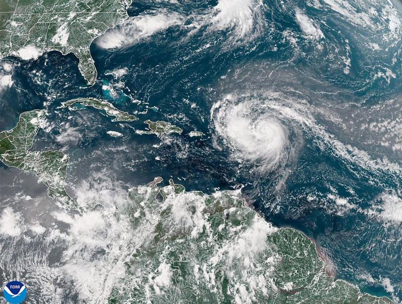
Hurricane Erin has intensified into a category five hurricane with winds reaching 160 mph (260 km/h). The storm is moving through the Atlantic and is expected to pass north of islands like the Leeward Islands and Puerto Rico, bringing heavy rain and potentially dangerous conditions. Erin is not expected to hit the U.S. mainland, but it will create hazardous surf along the U.S. East Coast.Key Facts
- Hurricane Erin has reached category five status with winds of 160 mph.
- It intensified rapidly from a tropical storm in a short time.
- Erin will pass north of the Leeward Islands, Virgin Islands, and Puerto Rico, possibly causing up to 6 inches of rain.
- Flash flooding and mudslides are potential risks from the storm.
- Erin is not forecasted to make landfall in the mainland U.S.
- It will cause life-threatening surf and rip currents along the U.S. East Coast.
- Dangerous surf conditions are expected in Florida, mid-Atlantic states, Bermuda, and Puerto Rico.
- The U.S. Coast Guard has set restrictions in some ports in the U.S. Virgin Islands and Puerto Rico due to the storm.
Read the Full Article
This is a fact-based summary from The Actual News. Click below to read the complete story directly from the original source.

