Why Oval Office map has played crucial role in Trump's view of Ukraine war
Summary
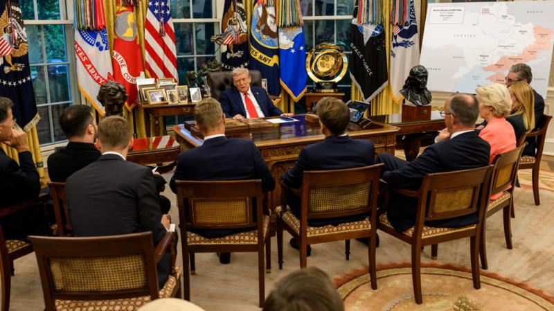
A large map in the Oval Office showing Russian-occupied parts of Ukraine played a central role in discussions between former President Donald Trump and Ukrainian President Volodymyr Zelensky. Trump emphasized Russian control over Ukrainian territory, suggesting potential territorial compromises. Zelensky countered this view, citing his own map and arguing against misconceptions about territorial control.Key Facts
- The Oval Office map highlighted areas of Ukraine under Russian control, shown in red.
- Trump used this map during a meeting with Zelensky to discuss the situation in Ukraine.
- Trump suggested considering a territorial compromise with Russia.
- Zelensky presented a different map to challenge the depiction of control.
- Key regions under Russian control include Luhansk (99%), Donetsk (76%), and smaller percentages in other areas.
- The Institute of War analysis supports similar control figures to the White House map.
- Ukrainian regions have seen changes in control since the war's start in 2014.
- Russian advances have occurred recently, but overall territorial changes have been limited.
Read the Full Article
This is a fact-based summary from The Actual News. Click below to read the complete story directly from the original source.
