Warm Water Captured by Satellite Hints Super El Niño Coming This Year
Summary
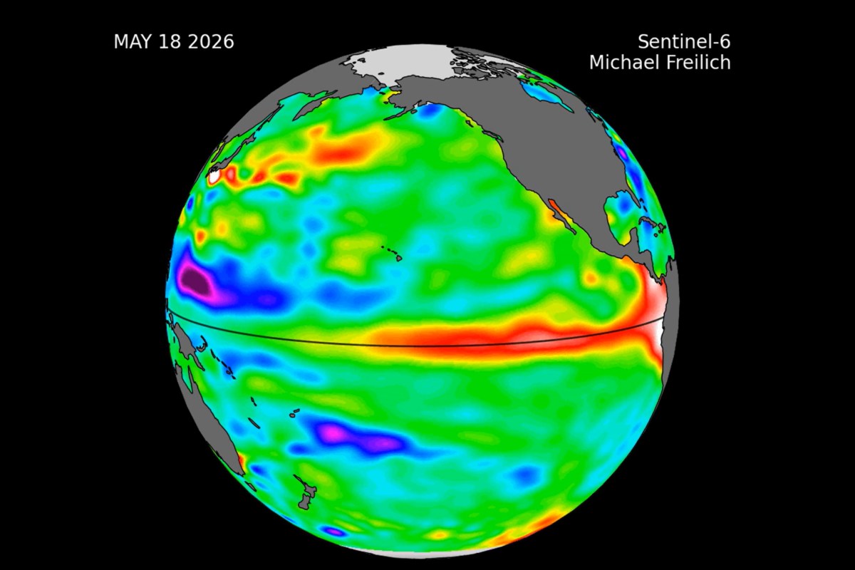
Satellite data shows a large area of unusually warm water spreading across the Pacific Ocean, which NASA says may signal the start of an El Niño event later this year. El Niño is a natural climate cycle that changes ocean temperatures and weather patterns, often causing significant effects globally.Key Facts
- NASA used the Sentinel-6 Michael Freilich satellite to measure warm water and rising sea levels in the Pacific Ocean.
- Warm water detected by the satellite stretches hundreds of miles along the equator, moving toward South America.
- El Niño is the warm phase of a natural climate cycle called ENSO that happens every 2 to 7 years.
- During El Niño, trade winds weaken and push warm water eastward, influencing weather around the world.
- Possible effects in the U.S. include warmer, drier weather in the north and wetter conditions in the Gulf Coast and Southeast.
- El Niño can reduce Atlantic hurricane activity but increase hurricanes in the Pacific.
- Scientists observed "Kelvin waves," pulses of warm water moving east, which are signs El Niño could develop.
- Multiple Kelvin waves over several months usually lead to a full El Niño event, and this process is currently underway.
Read the Full Article
This is a fact-based summary from The Actual News. Click below to read the complete story directly from the original source.