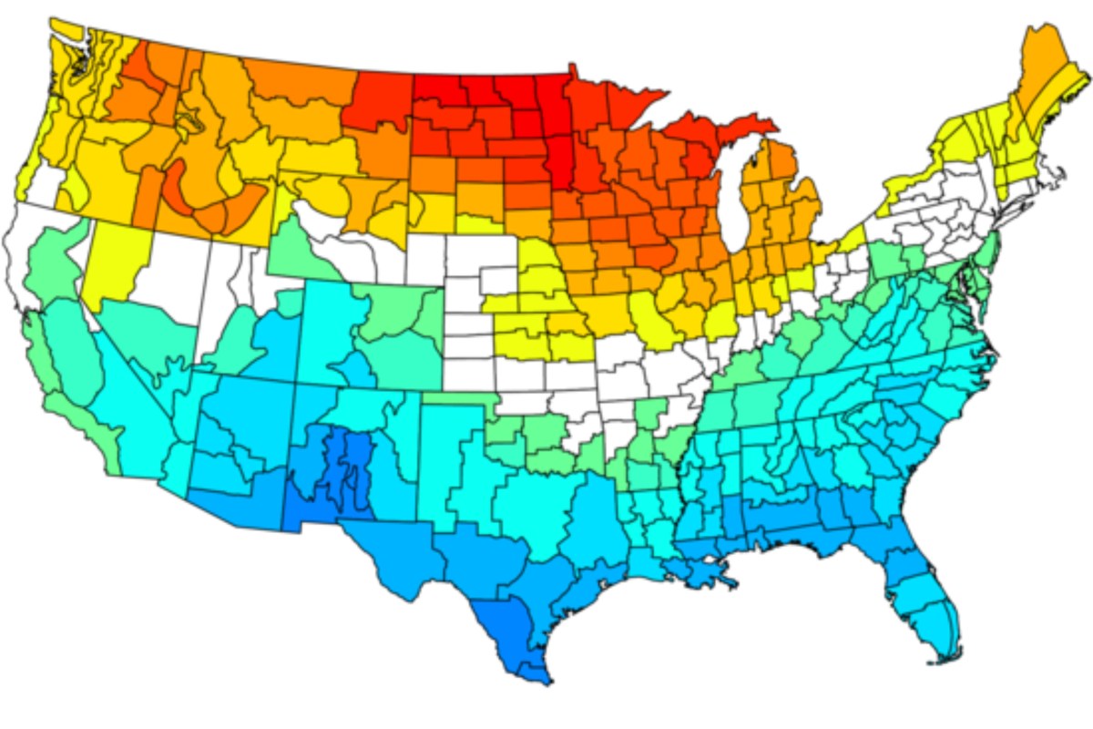
Maps Show How 2026 El Niño Could Impact the US
Summary
The National Weather Service expects an El Niño weather event to likely start between May and July 2026. El Niño is a natural climate cycle that warms the tropical Pacific Ocean and can affect temperatures and rainfall across the United States. Maps show that stronger El Niño events usually bring warmer temperatures to northern U.S. states and wetter conditions to the southern states.Key Facts
- There is an 82% chance El Niño will appear between May and July 2026.
- El Niño is the warm phase of a climate cycle called the El Niño–Southern Oscillation (ENSO), which happens every 2 to 7 years.
- Strong El Niño events heat parts of the U.S. north, from the Pacific Northwest to the Northeast, especially in winter.
- During El Niño, southern regions like California, the Gulf Coast, and Florida often get more rain.
- Areas like eastern Texas and the Ohio Valley may be drier during weaker El Niño events.
- El Niño can increase flood risk in some regions and worsen heat, drought, and wildfires in others, especially the Northwest.
- A marine heat wave off the West Coast combined with El Niño might cause more thunderstorms in the southern U.S.
Read the Full Article
This is a fact-based summary from The Actual News. Click below to read the complete story directly from the original source.