Iran nuclear and military damage revealed after restricted satellite images released
Summary
New satellite images from almost 800 places in Iran show damage to military and nuclear sites caused by US-Israeli strikes since March 9. The images reveal destruction to buildings, ammunition storage, missile bases, naval docks, and airports in cities like Bushehr and Esfahan.Key Facts
- Over 250,000 high-resolution satellite images previously restricted have been released by Planet Labs after a US government request.
- The images show damage at Esfahan and Bushehr, including destroyed military buildings, ammunition areas, aircraft, ships, and missile sites.
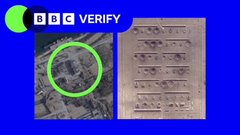
- Bushehr’s military and government facilities, including aircraft hangars and missile launch sites, suffered heavy damage, with some buildings flattened.
- Craters from attacks were found on Bushehr International Airport runways, with some repaired since.
- More than 60 military structures were damaged or destroyed near Esfahan, including at the Shekari 8 airbase and locations near Baharestan.
- The restrictions on satellite images limited independent checks of the conflict’s impact on military and civilian facilities.
- Restrictions still block access to images for most of the Middle East, including Iraq, Lebanon, Israel, and Gaza.
- Media outlets have sought satellite imagery from non-US sources due to the ongoing limits on Planet Labs’ photos.
Read the Full Article
This is a fact-based summary from The Actual News. Click below to read the complete story directly from the original source.