Maps Reveal Where Severe Storm Could Unleash Flash Flooding This Weekend
Summary
Severe thunderstorms are expected across many parts of the United States this weekend, bringing a risk of flash floods in several areas. After the storms, a strong heat dome may cause very high temperatures in the Midwest and East.Key Facts
- Flash floods happen when rain falls faster than the ground can soak it up and can start quickly.
- Areas with a lot of buildings and roads are more likely to have flash floods because water cannot soak into the ground easily.
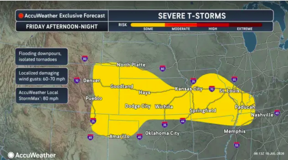
- Strong wind gusts up to 70 mph and possible tornadoes could occur in parts of Colorado, Wyoming, New Mexico, Kansas, Kentucky, and Tennessee on Friday.
- Thunderstorms with wind speeds around 55 to 65 mph are forecasted for parts of North Carolina, Pennsylvania, and New Jersey on Friday.
- On Saturday, northeastern Georgia and much of Virginia may see thunderstorms with flash flood risks and winds up to 60 mph.
- By Sunday, storms could move south to northern Louisiana, Mississippi, Alabama, Georgia, and the Carolinas with heavy rain and strong winds.
- The National Weather Service has issued flood watches and warnings in states including Iowa, Wisconsin, Missouri, South Dakota, Illinois, Kentucky, and Colorado.
- After the storms, a heat dome could bring temperatures as high as 115 degrees Fahrenheit to the Midwest and Eastern U.S.
Read the Full Article
This is a fact-based summary from The Actual News. Click below to read the complete story directly from the original source.