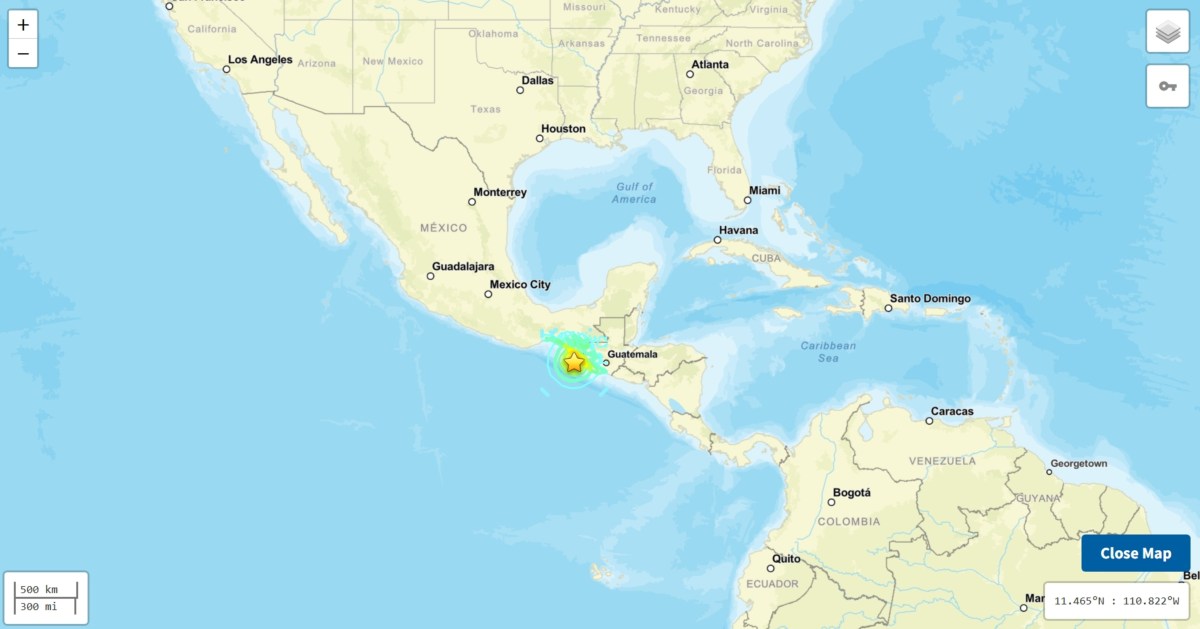
Mexico Earthquake: Map Shows Where 7.3 Magnitude Tremor Hit Coastline
Summary
A strong earthquake with a magnitude of 7.3 hit off the southern coast of Mexico near Chiapas early Friday morning. No deaths or major damage were reported immediately, but officials are checking buildings and watching for possible tsunamis.Key Facts
- The earthquake had a magnitude of 7.3.
- It struck near the Pacific coast in Chiapas state, Mexico.
- The epicenter was about 30 miles southwest of Aquiles Serdán, close to Puerto Madero near the Guatemala border.
- The quake occurred at a shallow depth, which can cause stronger shaking over a larger area.
- There were no immediate reports of deaths or serious damage.
- Emergency teams are reviewing infrastructure for safety.
- Authorities are monitoring coastal areas in case a tsunami develops.
- Videos on social media showed strong shaking during the earthquake.
Read the Full Article
This is a fact-based summary from The Actual News. Click below to read the complete story directly from the original source.