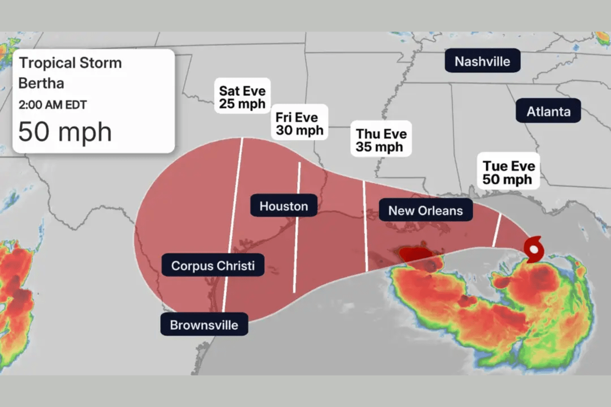
Tropical Storm Bertha Tracker Map Shows Where Landfall Expected This Week
Summary
Tropical Storm Bertha is moving slowly near the northern Gulf Coast, bringing heavy rain, coastal flooding, and a dangerous storm surge to parts of Florida, Alabama, Mississippi, and Louisiana. The National Hurricane Center expects Bertha to remain a tropical storm and worsen flooding risks through the week.Key Facts
- Tropical Storm Bertha became the second named storm of the 2026 Atlantic hurricane season.
- The storm is currently about 125 miles south of Panama City, Florida, with winds of 50 mph moving northwest at 2 mph.
- Bertha is forecast to move near the northern Gulf Coast, approaching southeastern Louisiana by Wednesday.
- A Storm Surge Watch is in effect from the Alabama-Florida border to the mouth of the Mississippi River with water levels possibly rising 2 to 4 feet above normal.
- Heavy rainfall totaling 2 to 4 inches is expected along the Gulf Coast, with some areas possibly seeing up to 8 inches.
- Flash flooding and isolated tornadoes are possible, especially in urban and low-lying areas.
- Tropical Storm Warnings cover parts of the Gulf Coast from the Alabama-Florida border to areas in Louisiana.
- Experts say hostile wind and dry air may limit the storm's strengthening, with rainfall being the main threat.
Read the Full Article
This is a fact-based summary from The Actual News. Click below to read the complete story directly from the original source.