Spokane Fire Satellite Images As Millions Told To Stay Inside
Summary
Large wildfires near Spokane, Washington, have caused heavy smoke to spread across several states and Canadian provinces, damaging hundreds of buildings and forcing about 60,000 people to evacuate. The smoke has made air quality very dangerous, leading officials to warn residents to stay indoors and limit outdoor activities.Key Facts
- Wildfires near Spokane include the Old Trails Fire, Fairview Fire, and Autumn Lane Fire.
- By August 2, these fires burned about 5,400 acres, growing to over 7,500 acres later.
- Around 700 buildings have been destroyed, causing evacuations of roughly 60,000 people.
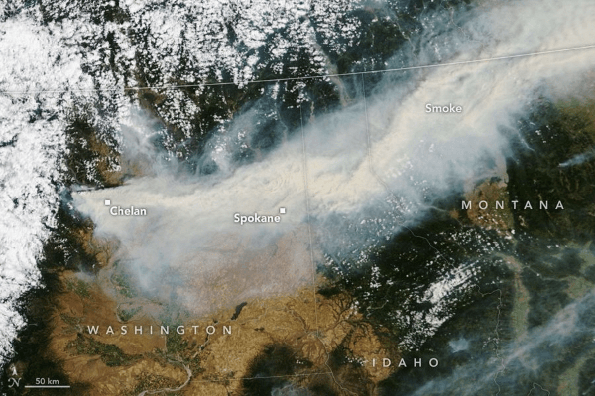
- NASA satellite images show thick smoke moving from Washington into Idaho, Montana, and parts of Canada.
- The air quality in Spokane and nearby counties reached “Very Unhealthy” levels due to fine particles called PM2.5.
- PM2.5 particles are tiny and can harm lungs and the heart, especially affecting vulnerable groups.
- The National Weather Service issued Washington’s first-ever “particularly dangerous situation” fire weather alert because of strong winds, heat, and dry fuel.
- Authorities advised people to avoid outdoor burns, stop activities that create sparks, and follow fire safety rules during Red Flag Warnings.
Read the Full Article
This is a fact-based summary from The Actual News. Click below to read the complete story directly from the original source.