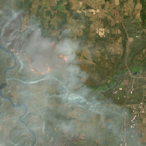
Europe's free satellite service just made it easier to track wildfires
Summary
Europe’s free Copernicus Browser now includes a new wildfire visualization layer for satellite images from the Sentinel-2 mission. This layer shows active fires, burning vegetation, and burned areas clearly, making it easier for anyone to track wildfires using detailed satellite data.Key Facts
- The Copernicus Browser gives free access to satellite images from the European Space Agency’s Sentinel satellites.
- Sentinel-2 satellites provide high-resolution images up to 10 meters in size, useful for monitoring wildfires.
- A new wildfire layer was added to the Copernicus Browser on August 4, showing fires in white or yellow, burning vegetation in red, and burned land in brown or black.
- This visualization is based on a JavaScript script created by remote sensing expert Pierre Markuse.
- The script combines different parts of the light spectrum to highlight fires and changes in vegetation.
- The integration of this script as a default option in the browser was promoted by Simon Proud, a Sentinel-2 mission scientist.
- NASA also offers wildfire monitoring tools, but Sentinel-2 provides higher image detail, updated every few days.
- Wildfires continue to be a serious issue worldwide, made worse by climate change, affecting places like the US, Canada, France, and Spain.
Read the Full Article
This is a fact-based summary from The Actual News. Click below to read the complete story directly from the original source.