Map Shows Where Millions of Americans At Risk as Canadian Wildfires Explode
Summary
Massive wildfires in British Columbia, Canada, have caused widespread evacuations and a provincial state of emergency. Smoke from these fires is traveling hundreds of miles into the United States, leading to poor air quality and health warnings in many American states.Key Facts
- Wildfires near Summerland and Peachland in British Columbia triggered one of the biggest evacuation events of the year.
- Over 20,000 people were forced from their homes due to the Bald Range wildfire.
- About 1,500 firefighters are working across British Columbia to control more than 100 active fires.
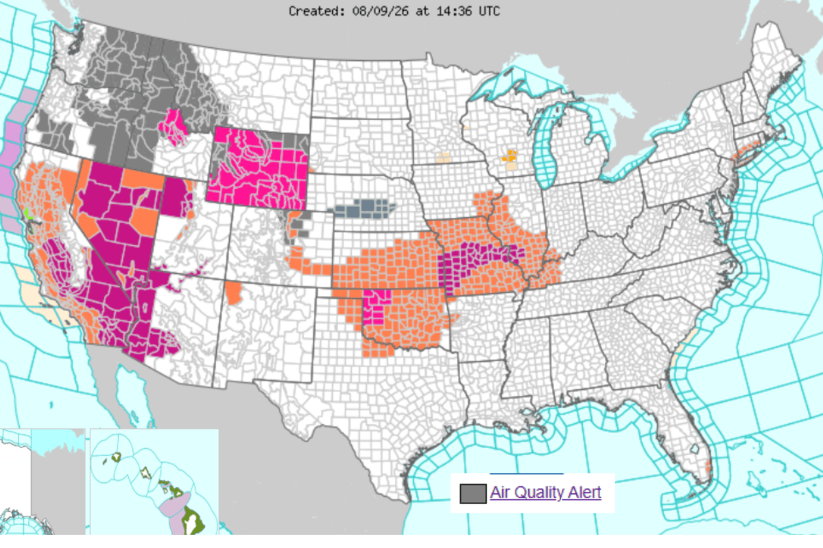
- Smoke from Canadian wildfires is spreading into the U.S., affecting air quality in the Midwest, Great Lakes, Northeast, and Mid-Atlantic regions.
- Air quality alerts have been issued in states like Washington, Oregon, Colorado, Idaho, Montana, and Wyoming due to unhealthy smoke levels.
- Wildfire smoke contains fine particles that can worsen asthma, heart disease, and other breathing problems, especially in vulnerable groups.
- So far in 2024, about 3.9 million hectares of land have burned across Canada.
- Weather conditions like heat, dry plants, and wind are making the fires worse and could continue this summer.
Read the Full Article
This is a fact-based summary from The Actual News. Click below to read the complete story directly from the original source.