Map Shows Where California Is Quickly Sinking Amid US Water Crisis
Summary
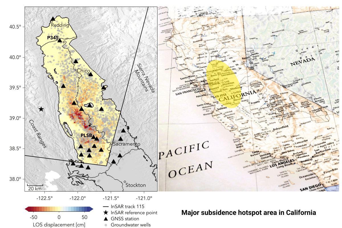
New research shows parts of California’s Sacramento Valley are sinking fast due to heavy pumping of underground water during recent droughts. This sinking, called land subsidence, can cause permanent damage to the underground water storage and affect farming and local infrastructure.Key Facts
- The Sacramento Valley sank as much as 1.5 feet in one year during the 2020-2022 drought.
- Farmers pumped more groundwater when reservoirs and rivers had less water.
- A study found the sinking shifted from being mostly reversible to permanently compressing underground sediments.
- Permanent compression reduces the aquifer’s ability to store water, even when rains return.
- Scientists used satellite data to observe land sinking across a wide area.
- Traditional groundwater wells didn’t show the full extent of the problem.
- The Central Valley is a critical farming area that depends on groundwater during droughts.
- Land sinking can damage roads, bridges, canals, and increase flood risks.
Read the Full Article
This is a fact-based summary from The Actual News. Click below to read the complete story directly from the original source.