Europe's scorched landscapes seen from space after summer heatwaves
Summary
This summer's heatwaves have caused severe damage across western Europe, visible in satellite images that show dried rivers, retreating glaciers, and large wildfires. Climate change has made these extreme heat events more frequent and intense, affecting landscapes and human activities.Key Facts
- Western Europe experienced its hottest June-to-July period on record, confirmed by the EU's climate monitoring service, Copernicus.
- The Danube River has reached its lowest water levels in 30 years, revealing things like mammoth bones and a sunken WWII ship.
- Some nuclear power plants along the Danube have shut down or reduced output because they can't use the river water to cool their systems.
- Alpine glaciers are melting faster due to less winter snow and early heatwaves; the Rhone Glacier has retreated by about 50 meters since last year.
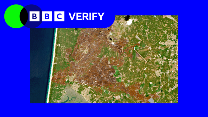
- Over 90,000 hectares of land have burned in France this summer, the worst wildfire season on record there.
- The largest fire in the Gironde region near Bordeaux burned 42,000 hectares, roughly the size of the Isle of Wight.
- Climate change is causing more frequent and intense wildfires by drying out vegetation and soil faster.
- Satellite images clearly show large areas of brown, dried-out land compared to previous years.
Read the Full Article
This is a fact-based summary from The Actual News. Click below to read the complete story directly from the original source.