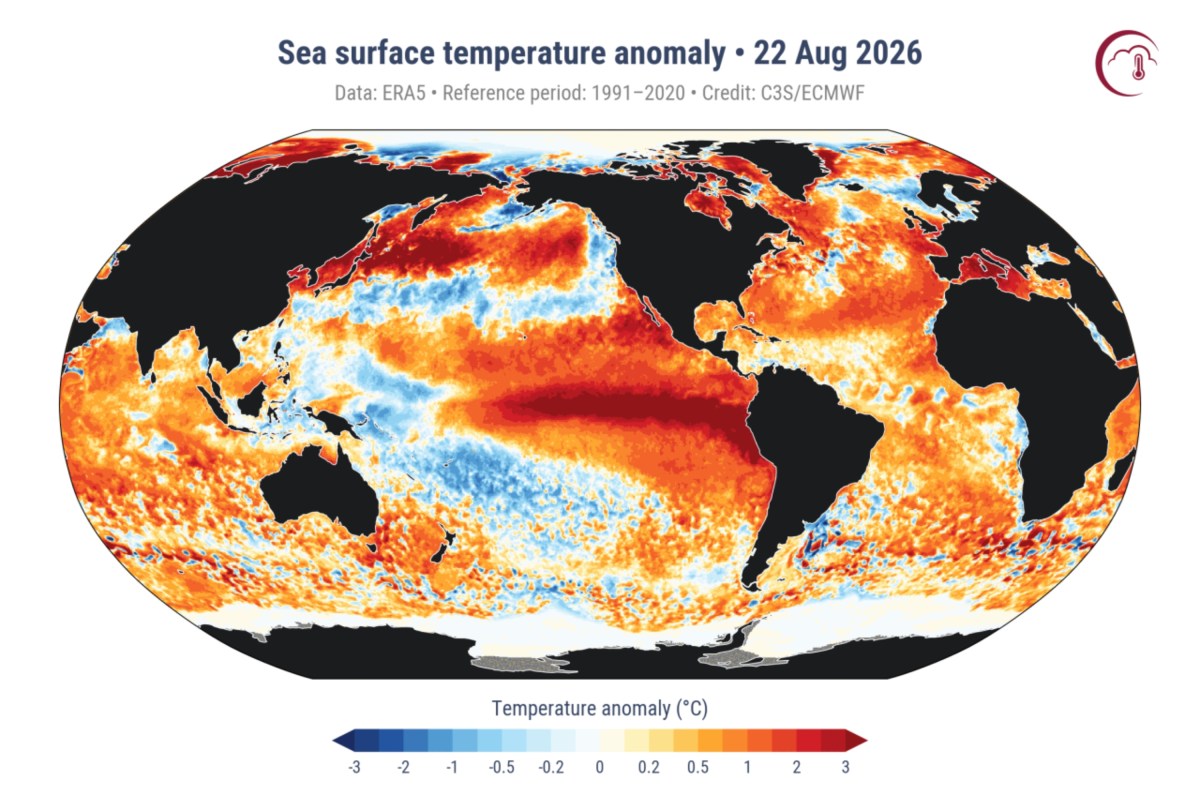
How El Niño's Record Ocean Warming Could Threaten US
Summary
The world's ocean surface reached a record-high temperature in August 2024, and a strong El Niño weather pattern is developing. These changes could affect storms, rainfall, and temperatures across the United States this fall and winter.Key Facts
- The global average sea-surface temperature hit 21.1°C (around 70°F), surpassing the previous record from March 2024.
- Ocean temperatures are usually highest in March or April, making the August record unusual.
- El Niño is a climate pattern where parts of the tropical Pacific Ocean become warmer than normal.
- Forecasters expect a strong El Niño event through fall and winter with over 90% chance.
- Warm ocean water causes more evaporation, putting extra moisture into the air.
- El Niño can change the jet stream’s path, influencing where storms travel across North America.
- The Southern U.S., including California and the Southwest, may have more rain or snow during this El Niño.
- The northern U.S. and southern Canada could experience warmer-than-average winter temperatures.
Read the Full Article
This is a fact-based summary from The Actual News. Click below to read the complete story directly from the original source.