Live Tracker Maps as Tropical Rainstorm Set to Hit US Coast
Summary
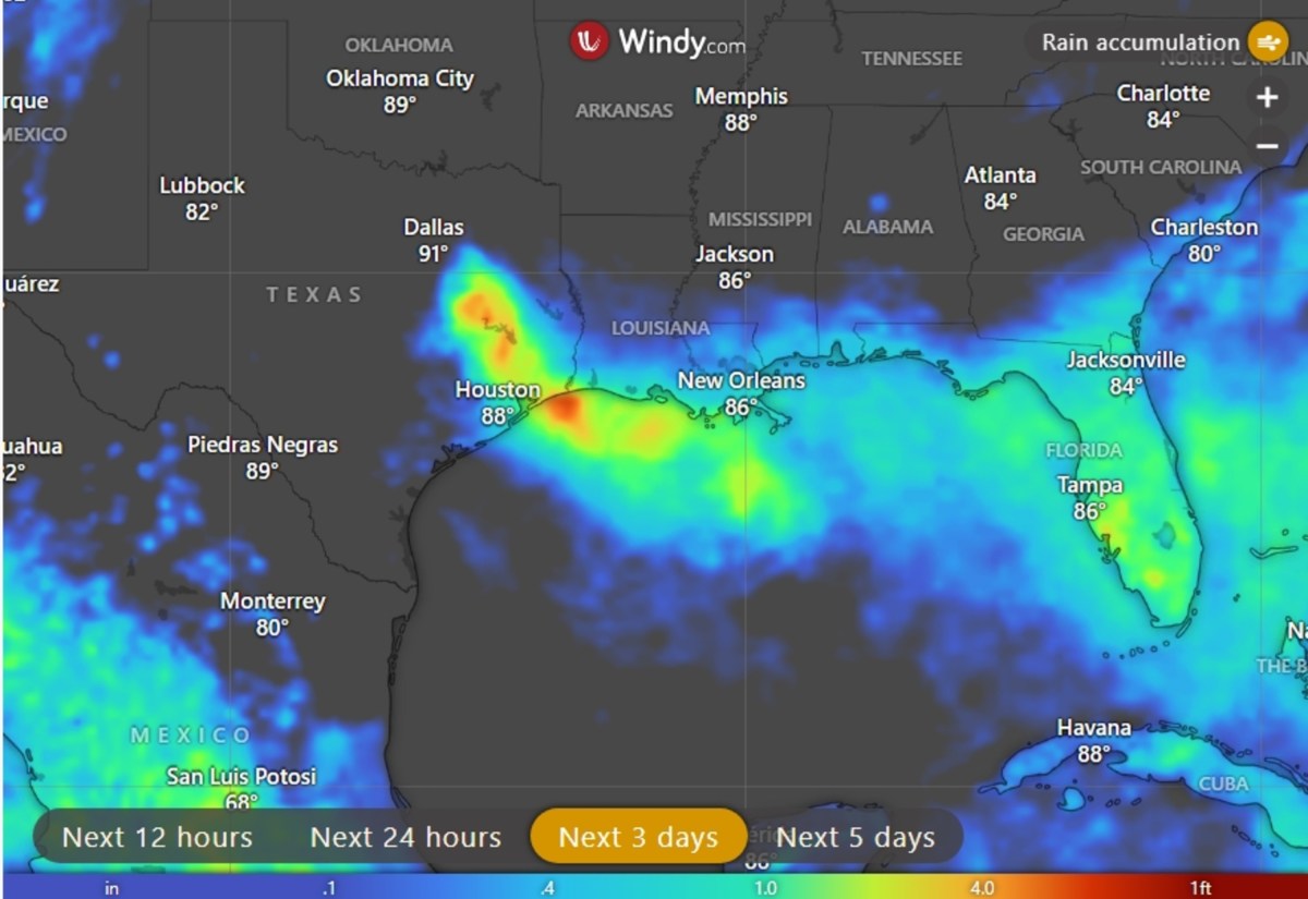
A tropical rainstorm, called Potential Tropical Cyclone Five, is moving toward the northern Gulf Coast and will bring heavy rain and possible flash flooding to parts of Texas and Louisiana. The storm may become a named tropical storm before hitting the coast but is not expected to cause strong winds.Key Facts
- The storm is causing sustained winds of 35 mph as it moves toward the upper Texas and southwestern Louisiana coast.
- Tropical storm warnings are in effect for parts of the Texas and Louisiana coastline.
- Rainfall of 3 to 6 inches is expected, with some areas possibly receiving up to 9 inches or more.
- Heavy rain could cause flash flooding, especially in low-lying and urban areas.
- Houston and surrounding areas may see the most rain, with potential travel delays during peak hours.
- Wind impacts are expected to be minor, with some gusty winds and rough seas near the coast.
- The storm is expected to weaken quickly after moving inland over southeastern Texas.
- Tropical moisture will remain, causing continued showers and storms across the central Gulf Coast for several days.
Read the Full Article
This is a fact-based summary from The Actual News. Click below to read the complete story directly from the original source.


