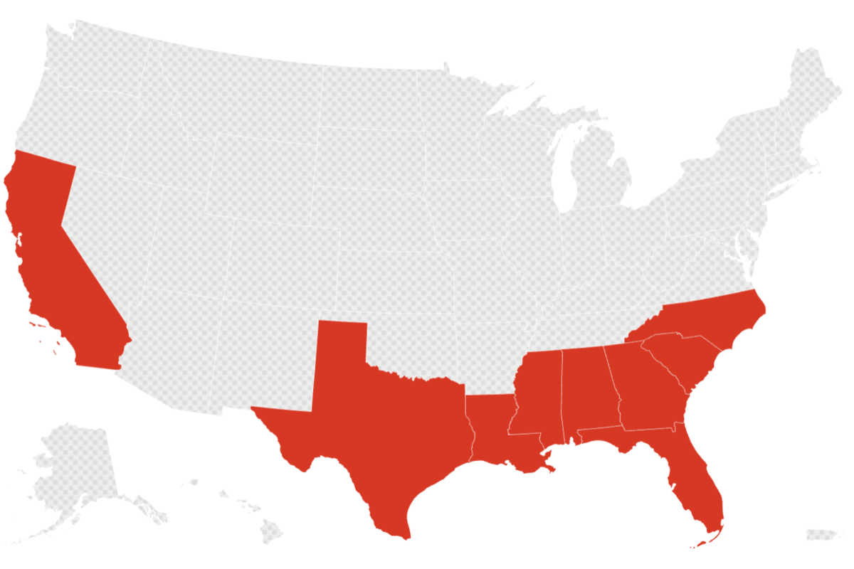
El Niño Update Signals ‘Unprecedented’ Weather—Map of Most Impacted States
Summary
El Niño, a weather pattern caused by warm ocean temperatures in the Pacific, is getting stronger and could bring severe weather to the United States this winter and into early 2027. California, the Southeast, and other parts of the country may see more storms, heavy rain, and warmer temperatures, while some northern areas might be drier.Key Facts
- El Niño happens when the surface of the Pacific Ocean near the equator becomes warmer than usual.
- This warming changes weather patterns, often causing wetter weather in the southern U.S. and drier weather in parts of the north.
- NOAA says there is more than a 90% chance of a very strong El Niño this winter.
- California and Southeastern states could face more intense storms and wetter conditions.
- El Niño can bring a mix of weather including floods, droughts, and unusually warm temperatures.
- Some Western states might experience increased snow this winter.
- Historically strong El Niños have caused major weather disasters, like the 1997-98 floods in California.
- The El Niño event is expected to last through early 2027 and may be stronger than any since 1950.
Read the Full Article
This is a fact-based summary from The Actual News. Click below to read the complete story directly from the original source.