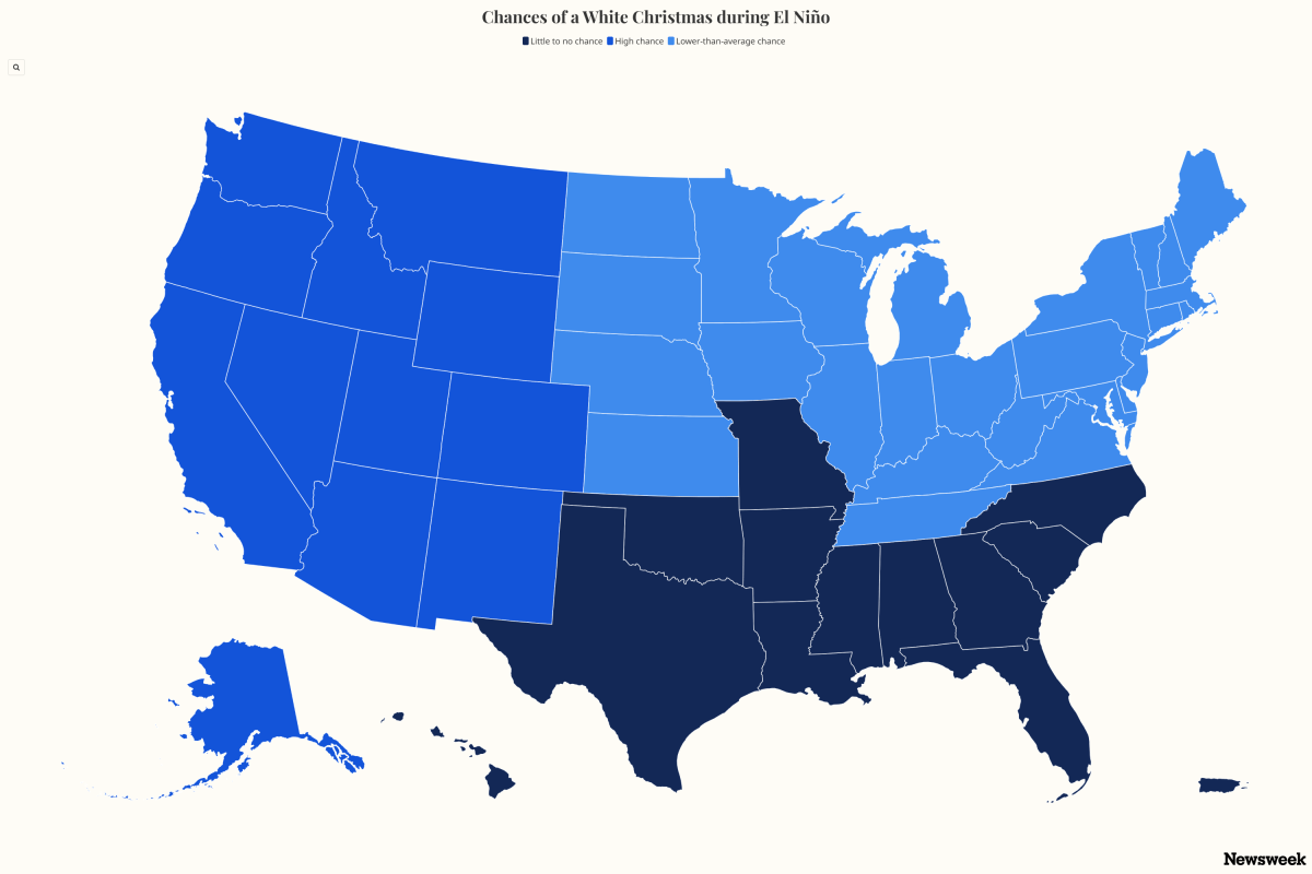
El Niño White Christmas Map Shows Snow Impact for Every State
Summary
A map shows the chances of having snow on the ground on Christmas Day across the United States. The map and weather experts say that a strong El Niño weather pattern may cause warmer winters, reducing the chance of a white Christmas for many states, especially in the east and south, while northern and mountainous regions still have higher chances of snow.Key Facts
- A white Christmas means having at least 1 inch of snow on the ground on December 25.
- Northern states, mountainous areas, and Alaska usually have the highest chances of snow at Christmas.
- The southern U.S., Gulf Coast, and Southeast generally have low chances for a white Christmas due to warmer temperatures.
- El Niño is a natural climate event where ocean temperatures in the tropical Pacific are warmer than usual.
- A strong El Niño can change weather patterns, often making southern U.S. winters stormier and northern U.S. temperatures warmer.
- The National Weather Service says there is over a 90% chance of a very strong El Niño this winter (2026-27), possibly the strongest since 1950.
- Warm conditions from El Niño may lower the odds of snow in many areas that usually have a white Christmas.
- Some places, including Alaska and high mountain regions in western states, remain likely to have snow regardless of El Niño.
Read the Full Article
This is a fact-based summary from The Actual News. Click below to read the complete story directly from the original source.