Maps Show Where Powerful Nor'easter Threatens Travel, Flooding This Week
Summary
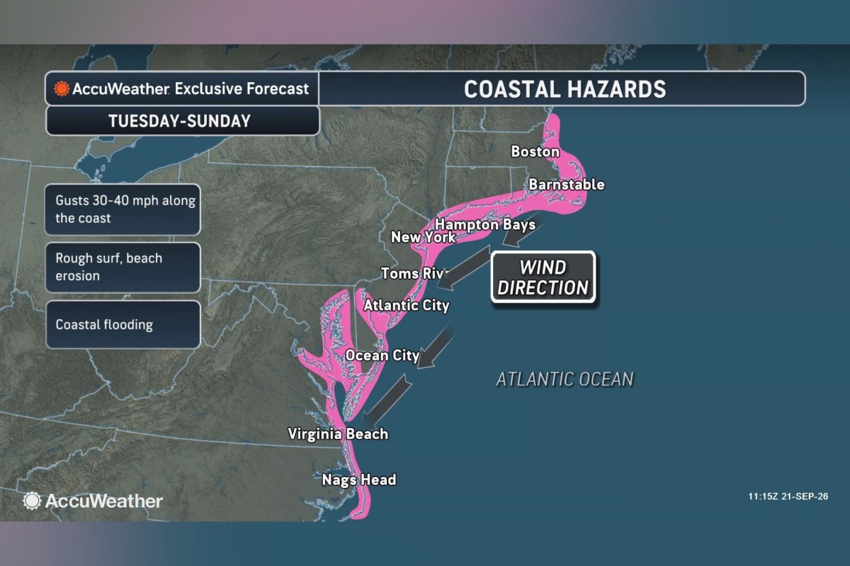
A nor’easter storm could hit the East Coast this week, bringing heavy rain, strong winds, flooding, and dangerous surf. Forecasters say the storm’s exact path and intensity are uncertain, but it may cause travel problems and coastal damage from North Carolina to New England.Key Facts
- A nor’easter is a storm with winds from the northeast along the U.S. East Coast, often causing heavy rain or snow, strong winds, and coastal flooding.
- The storm may develop late this week near the Northeast coast, possibly disrupting travel and causing high surf and erosion.
- High pressure near the Great Lakes and low pressure near the coast will interact, strengthening winds as the storm moves north.
- Forecast models differ; some predict the storm closer to shore with stronger impacts, others place it farther out at sea with fewer effects inland.
- Coastal flooding is likely from Tuesday through Friday in North Carolina, Virginia, Maryland, Delaware, New Jersey, and potentially southern New England.
- The full moon will increase high tide levels, which may worsen flooding along the coast.
- Wind gusts could reach 40 to 70 mph in some areas, with offshore waves as high as 15 to 18 feet.
- Coastal roads, like Highway 12 on the Outer Banks, may face ocean overwash, and power outages are possible where winds are strongest.
Read the Full Article
This is a fact-based summary from The Actual News. Click below to read the complete story directly from the original source.