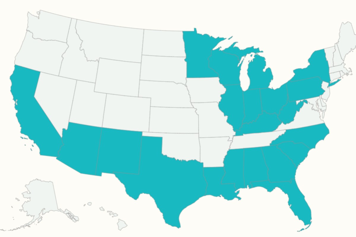
Map Shows States Most Exposed to El Niño Flood Risk
Summary
A strong El Niño event is expected to increase the risk of flooding across parts of the United States this winter, especially in California, the Southwest, and the southern states. Meteorologists warn that heavy rain and storms could cause flooding and other weather problems from fall through early spring.Key Facts
- El Niño is a natural climate pattern with warmer Pacific Ocean waters that changes weather worldwide.
- The current El Niño is breaking records and may become one of the strongest on record by the end of the year.
- Increased rainfall and flood risk are expected mainly in California, the Southwest (Arizona, New Mexico), Florida, and states along the Gulf Coast.
- Mountainous and steep areas in the Southwest risk fast-moving floodwater hitting roads and neighborhoods.
- In Florida, development on sandy soil reduces places for water to go, increasing flooding chances.
- The southern jet stream will bring more storms, heavy rain, and possible severe weather in the Southeast during winter.
- The Great Lakes and Ohio Valley could see more rain and less snow during milder El Niño conditions.
- Forecasts predict January and February will be especially wet in many affected regions.
Read the Full Article
This is a fact-based summary from The Actual News. Click below to read the complete story directly from the original source.


