New Google Maps images reveal massive scale of devastation in Gaza
Summary
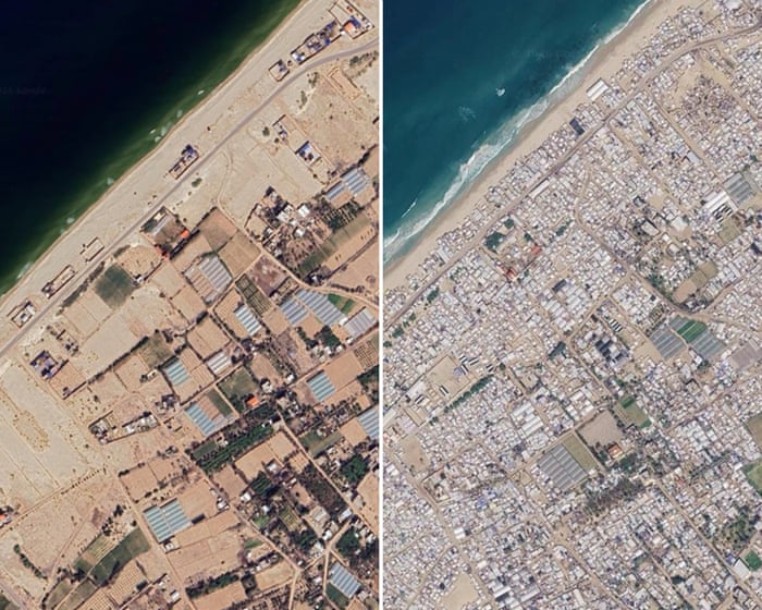
New images from Google Maps show how much damage Gaza has suffered during the three-year war and ongoing crisis. The photos reveal destroyed buildings, crowded tent camps, and widespread destruction across many towns and neighborhoods.Key Facts
- The images were taken in June 2026 and show damage continuing despite a ceasefire that began nearly 12 months ago.
- Many homes, businesses, places of worship, and infrastructure in Gaza have been destroyed or damaged.
- Large tent camps have appeared along the coastline and within Gaza City to shelter displaced people.
- Northern towns like Beit Lahiya and Beit Hanoun, and neighborhoods in Gaza City such as Jabaliya and Shuja’iya, are heavily damaged or uninhabitable.
- The UN says about 82% of Gaza’s buildings (roughly 200,000) are damaged, with two-thirds destroyed.
- Gaza has about 2.1 million displaced people living in temporary shelters.
- The UN estimates Gaza has 61 million tonnes of rubble, which is 20 times more than all rubble from wars worldwide in the past 18 years.
- More than 74,000 Palestinians have died in the conflict, mostly civilians; the war began after a Hamas attack on Israel in October 2023.
Read the Full Article
This is a fact-based summary from The Actual News. Click below to read the complete story directly from the original source.