Tropical Storm Isaias Tracker, Spaghetti Models as US Landfall Forecast
Summary
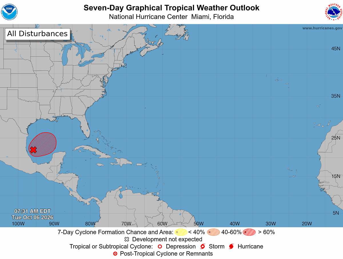
A tropical disturbance in the Gulf of Mexico is likely to become Tropical Storm Isaias soon. Forecasters expect it to move toward the northern Gulf Coast, possibly making landfall between eastern Louisiana and the Florida Panhandle later this week.Key Facts
- The National Hurricane Center is watching a system called Invest 92L in the Bay of Campeche with a high chance of becoming a tropical storm.
- Hurricane Hunter planes will investigate the storm to learn how strong it is and where it will hit.
- Most computer models predict the storm will come ashore somewhere between eastern Louisiana and the Florida Panhandle by Friday or Saturday.
- The highest risk areas include coastal Mississippi and Alabama.
- Forecasts may become clearer once the storm's center forms and the system organizes better within 24 hours.
- The storm could bring heavy rain, strong winds, storm surge (high water pushed ashore by wind), and isolated tornadoes.
- The exact landfall location may still change due to weather patterns and storm strength.
- Even areas away from the center may experience bad weather if the storm’s structure becomes unbalanced.
Read the Full Article
This is a fact-based summary from The Actual News. Click below to read the complete story directly from the original source.