Hurricane Isaias forecast to bring dangerous storm surge, with millions under warnings in US
Summary
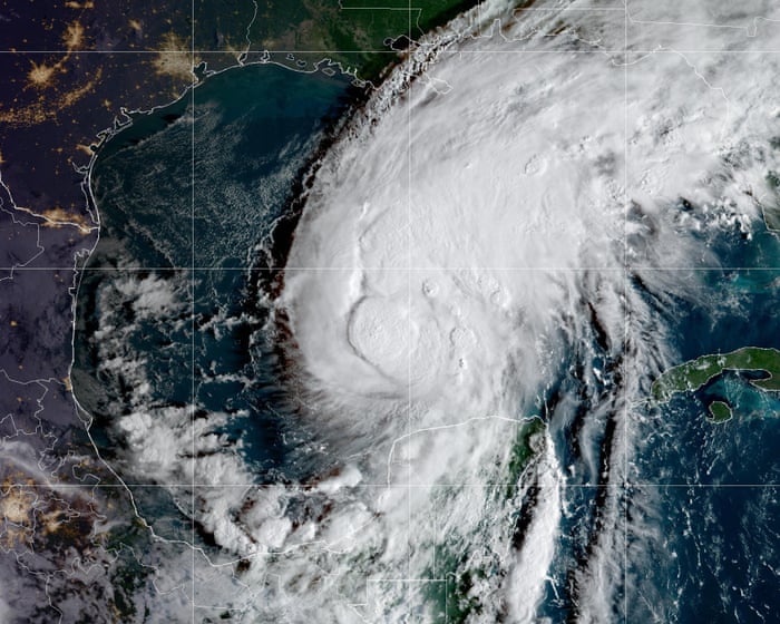
Hurricane Isaias, now a category 1 storm with 80 mph winds, is moving toward the northern Gulf Coast of the U.S., expected to arrive late Friday or early Saturday. Millions of people from Louisiana to Florida are under hurricane and storm surge warnings as officials prepare for strong winds, heavy rain, flooding, and possible tornadoes.Key Facts
- Hurricane Isaias strengthened from a tropical storm to a category 1 hurricane on Wednesday night.
- It is predicted to pass north of the Yucatán Peninsula before reaching the northern Gulf Coast.
- Life-threatening storm surge warnings cover areas from the mouth of the Mississippi River to Steinhatchee, Florida.
- Hurricane warnings are active from Ocean Springs, Mississippi, to the Bay/Gulf county line in Florida.
- Officials warn of damaging winds that could cause prolonged power outages in parts of Florida, Alabama, and Mississippi.
- Heavy rainfall may cause flash flooding, urban flooding, and isolated river flooding from the central Gulf Coast to the southeastern U.S.
- Tornadoes are possible Friday night in coastal Alabama, the Florida Panhandle, far southwestern Georgia, and continue Saturday in eastern Alabama, Georgia, and northern Florida.
- Alabama and Florida governors declared states of emergency in multiple counties, and some local areas have ordered evacuations.
- Schools are closing in Alabama and Florida, and the Federal Aviation Administration warned of possible Gulf route closures.
- Tennessee may see heavy rain and strong winds from Isaias’ remnants this weekend, with wind gusts possibly over 60-70 mph in mountain areas.
Read the Full Article
This is a fact-based summary from The Actual News. Click below to read the complete story directly from the original source.