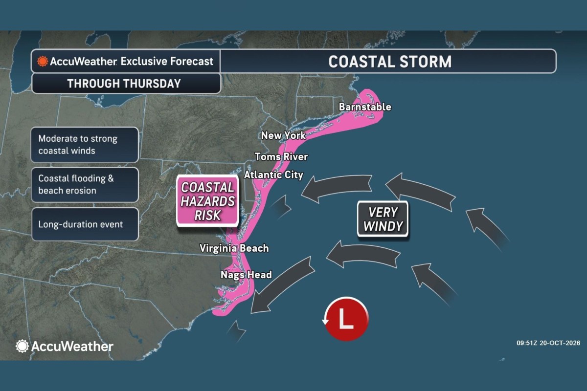
Map Shows East Coast States Facing Nor'easter Flood Threat This Week
Summary
A slow-moving nor’easter storm is expected to bring strong winds, coastal flooding, and beach erosion to East Coast states from North Carolina to Massachusetts through Thursday. The storm may develop tropical or subtropical features as it moves north offshore over warm Gulf Stream waters.Key Facts
- The nor’easter threatens coastal areas with moderate to strong winds, coastal flooding, and beach erosion.
- Coastal flood warnings are in effect for parts of New Jersey, Delaware, Maryland, and Virginia.
- Wind gusts between 40 and 60 mph are expected from Morehead City, North Carolina, to Atlantic City, New Jersey, with possible gusts up to 70 mph.
- The storm’s center will move from waters off the Carolinas toward the mid-Atlantic, southern New York, and New England.
- Coastal flooding could cause water levels to rise more than 2 feet above normal around high tide in places like Ocean City, Maryland.
- The system has a moderate chance to develop into a subtropical or tropical storm.
- Nor’easters usually bring northeast winds to East Coast coastal regions and are common and strong between September and April.
- Most inland areas away from the coast are expected to remain dry.
Read the Full Article
This is a fact-based summary from The Actual News. Click below to read the complete story directly from the original source.