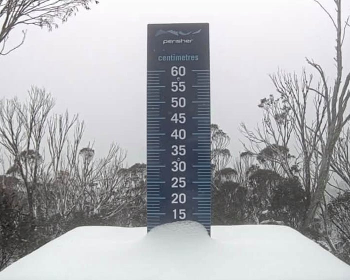
Cold blast brings springtime snow to alpine regions as temperatures plummet across Australia’s south-east
Summary
An unseasonal cold front brought snow to alpine areas of New South Wales, Victoria and Tasmania, while temperatures felt unusually low across several south-eastern Australian cities. The Bureau of Meteorology said warmer conditions were expected from Monday, with all capital cities forecast to reach at least 20°C by Tuesday.Key Facts
- Snow fell at Thredbo, Perisher and Mount Hotham, as well as Kunanyi/Mount Wellington in Hobart.
- The Bureau of Meteorology attributed the cold weather to air moving north from near Antarctica and south-westerly winds that lowered “feels like” temperatures.
- At midday, Adelaide, Melbourne, Hobart, Canberra and Sydney each had a feels-like temperature below 13°C.
- Adelaide recorded the highest midday temperature among those cities, at 17.5°C, which felt like 12.3°C.
- Canberra recorded the lowest midday maximum among those cities, at 12.9°C, which felt like 5.3°C.
- Brisbane, Perth and Darwin had temperatures in the 20s or 30s.
- The article says snow fell in some of the same locations in November 2022.
- The Bureau of Meteorology and other bodies warned that a strong El Niño could contribute to hotter, drier conditions in the Southern Hemisphere summer and increase wildfire and drought risks in Australia and southern Africa.
Read the Full Article
This is a fact-based summary from The Actual News. Click below to read the complete story directly from the original source.