What to know as "super El Niño" conditions take shape
Summary
NOAA classifies the developing El Niño as very strong, with sea-surface temperatures in part of the tropical Pacific more than 4°C above average as of Nov. 12, 2026. El Niño can shift temperatures and rainfall patterns around the world, raising risks of drought in some areas and flooding in others.Key Facts
- El Niño is a climate pattern marked by unusually warm water in a region of the tropical Pacific near the equator.
- El Niño events occur every two to seven years and usually last nine to 12 months.
- “Super El Niño” is not an official classification; NOAA and the World Meteorological Organization describe this event as very strong.
- NOAA identifies an El Niño event when tropical Pacific conditions meet its thresholds across five consecutive three-month periods.
- NOAA said sea-surface temperature anomalies in part of the tropical Pacific exceeded 4°C as of Nov. 12, 2026.
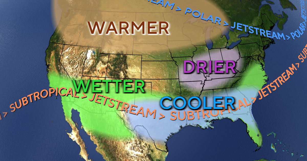
- El Niño often brings wetter winter conditions to southern North America and milder, drier conditions to the north.
- Drier conditions are typical in Australia, southern Asia, northern South America and central Africa during El Niño.
- El Niño can increase rainfall in eastern Asia and southern South America, potentially easing drought while raising flood risks.
Read the Full Article
This is a fact-based summary from The Actual News. Click below to read the complete story directly from the original source.