Polar Vortex Update: Map Shows States Facing 'Near Record Cold'
Summary
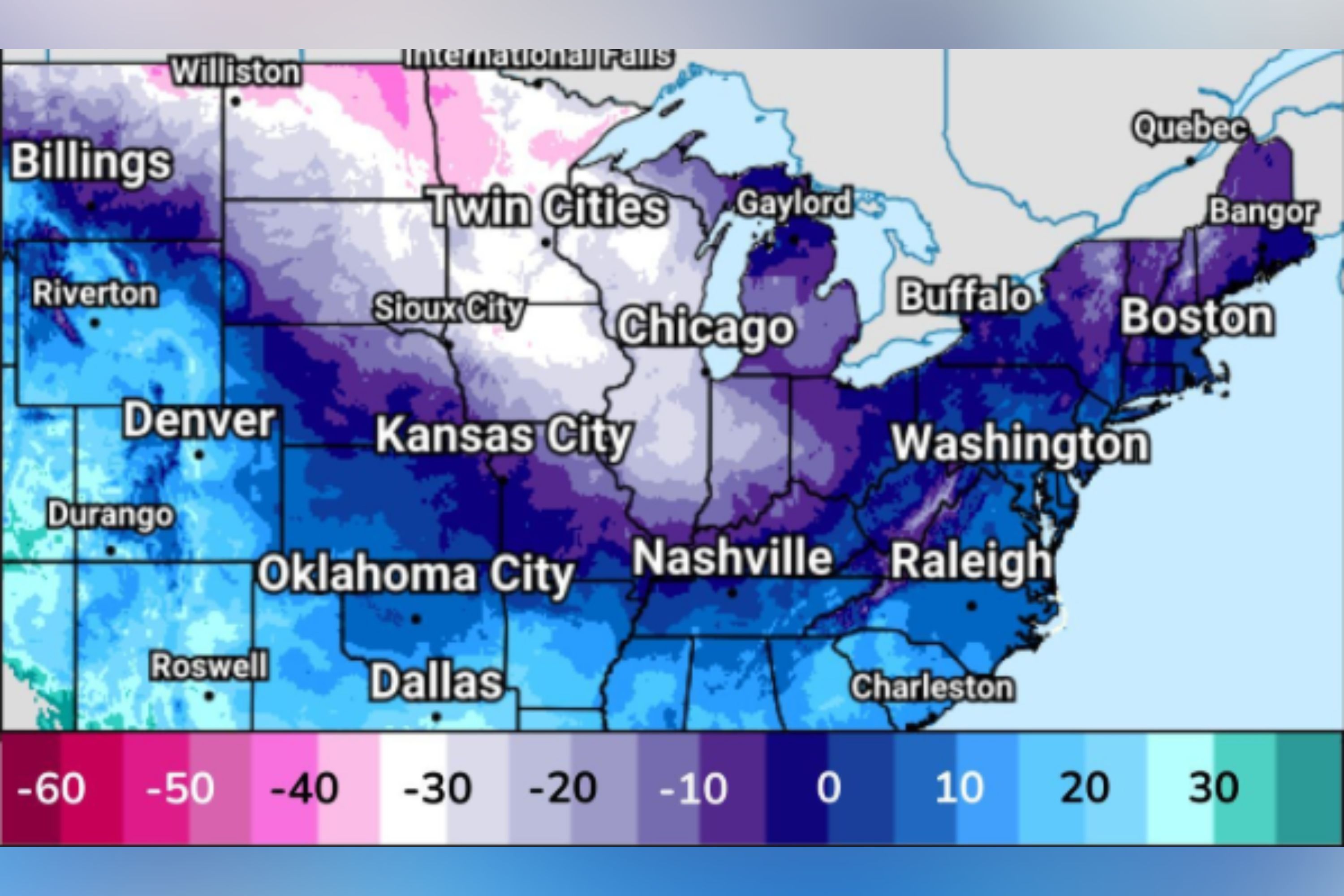
Arctic air from the polar vortex is causing extremely cold temperatures across parts of the United States. The cold wave, expected to bring temperatures well below normal, will spread from the Northern High Plains to the Mid-Atlantic over the weekend. The National Weather Service warns of dangerous wind chills and potential risks of hypothermia and frostbite.Key Facts
- Arctic air is moving south, bringing near-record cold across large parts of the U.S.
- Temperatures are expected to be 20-30 degrees below normal in some areas.
- The cold air will reach the Central Plains and Ohio Valley by Saturday, and the Mid-South and Mid-Atlantic by Sunday.
- The wind chill could drop to below 30 degrees in the Northern Plains and Midwest.
- The combination of cold and wind increases the risk of hypothermia and frostbite.
- The cold wave follows a series of weather systems from Canada bringing snow and cold to the Midwest and East.
- The United States Postal Service warns that wintry weather may affect mail delivery in several states.
Read the Full Article
This is a fact-based summary from The Actual News. Click below to read the complete story directly from the original source.
