Summary
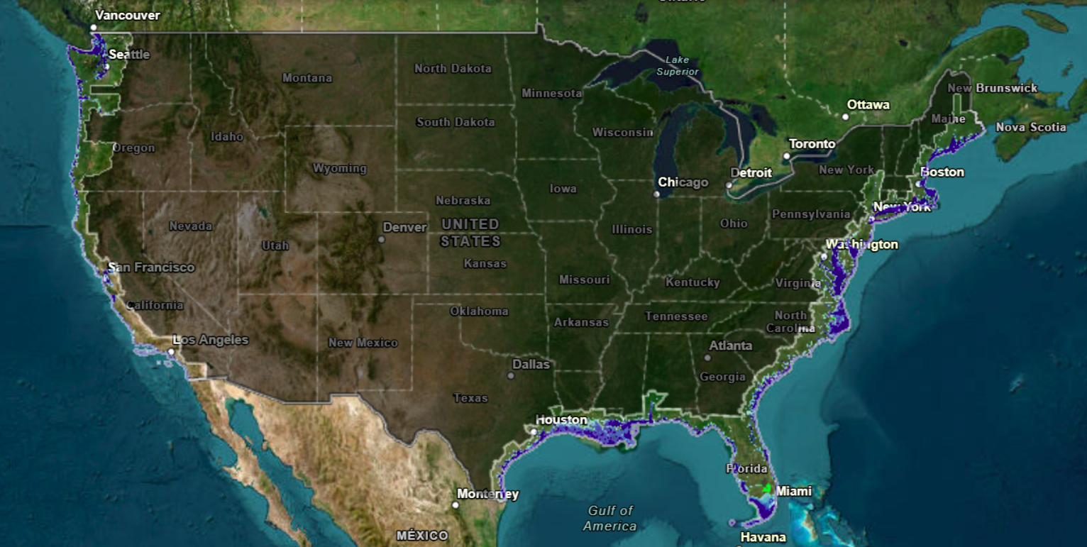
A map from the National Oceanic and Atmospheric Administration (NOAA) shows which U.S. coastal cities could be partially or fully submerged if sea levels rise by 10 feet. This rise would flood many cities from Washington state to Texas, with severe impacts on homes, infrastructure, and drinking water sources. The rise poses risks to low-income and marginalized communities who are already vulnerable.
Key Facts
- A NOAA map indicates U.S. coastal cities that could be submerged with a 10-foot sea level rise.
- Cities like Seattle, San Francisco, New York City, Boston, and Miami would be impacted.
- More than 5,500 sites storing hazardous materials could face flooding by 2100.
- Many sites could face flood risks by 2050, affecting low-income and marginalized communities most.
- A rise affects not just cities but also drinking water sources, through saltwater intrusion.
- Infrastructure like sewer and stormwater systems could fail as they rely on gravity flow.
- Areas further from the coast may experience freshwater flooding before sea levels rise.
- Rising sea levels can cause salt to enter groundwater, affecting drinking water far inland.