Summary
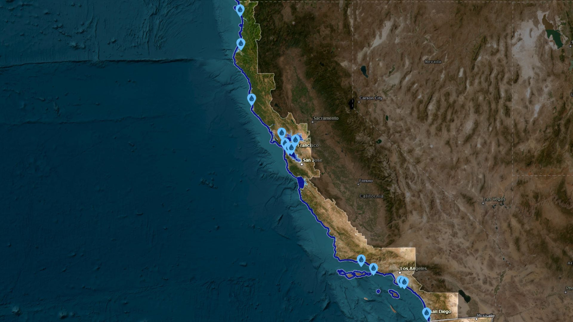
A map from the National Oceanic and Atmospheric Administration (NOAA) shows that if sea levels rise by 10 feet, many parts of California's coast could go underwater. Coastal cities like San Francisco and San Diego, as well as wildlife areas, would be affected. Experts say this might not happen before 2100, but small sea level increases can already impact coastal areas.
Key Facts
- NOAA's map shows a potential 10-foot sea level rise could flood parts of California's coast.
- Cities like San Francisco, Oakland, and San Diego could be partly underwater.
- Important wildlife areas like Humboldt Bay would also be affected.
- Rising sea levels are partly due to higher global temperatures and melting ice caps.
- A 10-foot sea level rise is not expected before 2100 but could still impact costs and communities.
- Experts suggest improving stormwater management and building barriers to mitigate flooding.
- Areas like the Golden Gate National Recreation Area could be heavily affected.
- Planning for resilience is essential to address potential future impacts.