New York Map Shows Cities That Could Go Underwater if Sea Levels Rise
Summary
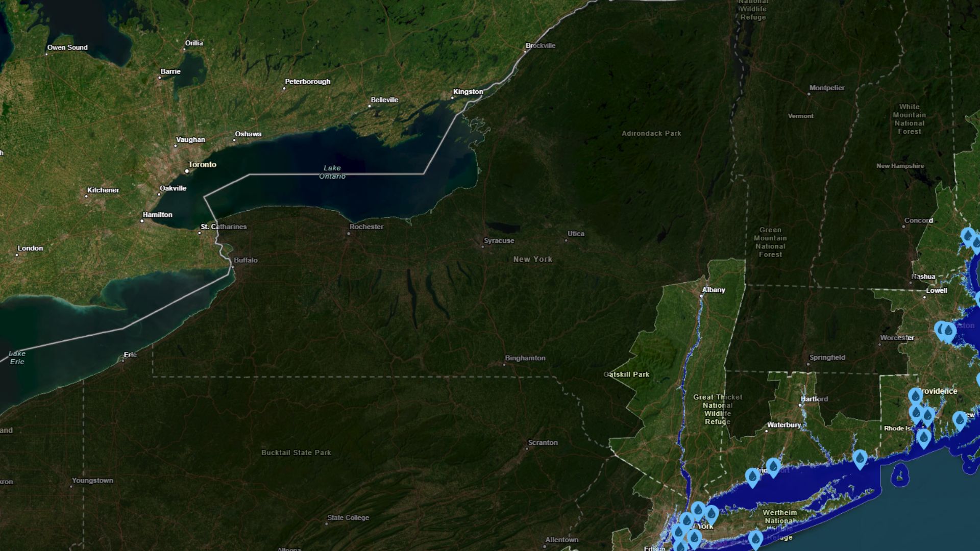
A map from the National Oceanic and Atmospheric Administration (NOAA) shows that if sea levels rise by 10 feet, major New York cities and many critical facilities could be flooded. Experts believe this sea level rise could happen within the next century due to factors like global warming and melting ice. The impact would affect cities, landmarks, and essential services like hospitals and fire stations.Key Facts
- NOAA created a projection map showing effects of a 10-foot sea level rise in New York.
- Major New York cities like New York City, parts of Brooklyn, Manhattan, and others would face flooding.
- Important landmarks like the Statue of Liberty and MetLife Stadium could be impacted.
- Sea level rise could also flood areas along the Hudson River, including smaller cities.
- Essential services, such as hospitals and fire stations, face risks from flooding.
- Experts say global warming, greenhouse gases, and melting ice contribute to rising sea levels.
- Even if greenhouse emissions stopped today, effects would continue for some time.
Read the Full Article
This is a fact-based summary from The Actual News. Click below to read the complete story directly from the original source.