Summary
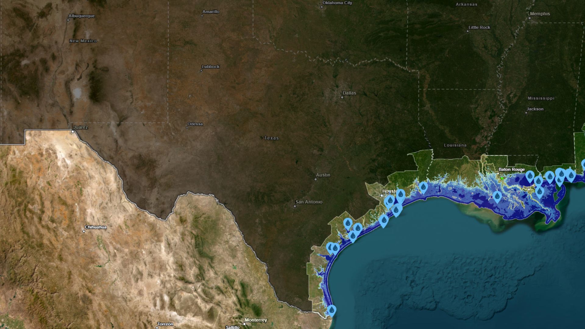
A map by NOAA shows that if sea levels rose by 10 feet, many coastal areas in Texas could be flooded. This could impact cities, public services, and wildlife areas. Experts have different opinions about when or if this level of sea rise might occur.
Key Facts
- The NOAA map shows potential flooding of Texas coastal areas if sea levels rise 10 feet.
- Major cities and services like hospitals and fire stations could be underwater.
- Pollution and public health risks could increase if facilities that handle waste are flooded.
- Even a 2 to 5 feet rise in sea level could cause significant flooding during high tides.
- Specific Texas cities and areas at risk include Galveston, Texas City, and Corpus Christi.
- Wildlife refuges like the McFadden National Wildlife Refuge could be submerged.
- Experts do not agree on when a 10-foot rise could happen, with predictions varying widely.
- Most U.S. coasts are expected to see a rise of 2 to 5 feet by 2100.