Map Shows States to Be Hit Hardest by 'Significant' Arctic Blast
Summary
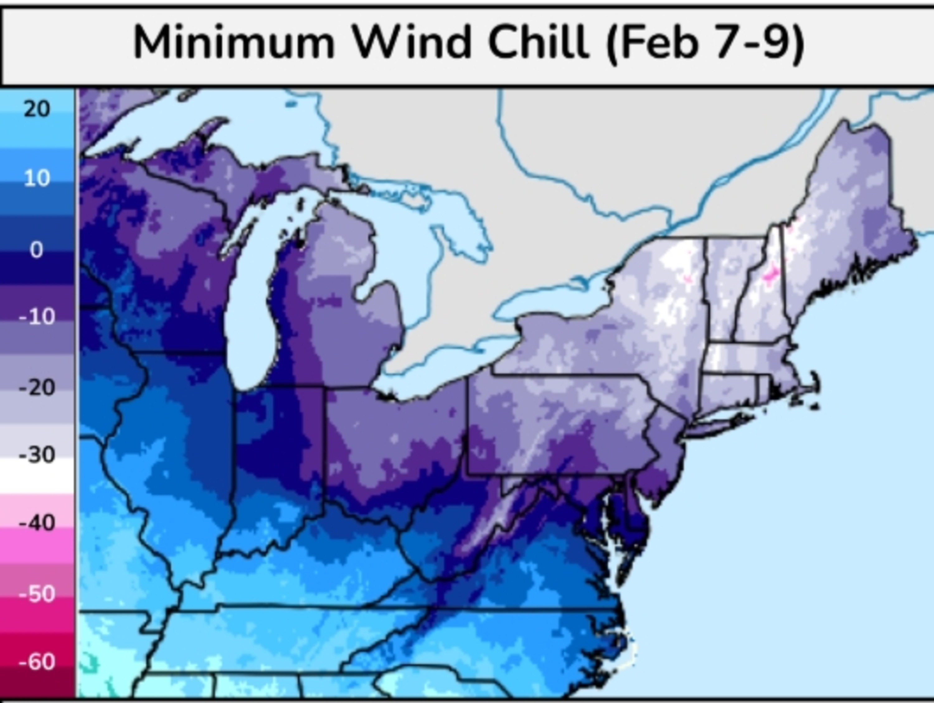
A strong arctic cold front is predicted to bring extremely low temperatures and dangerous wind chills to the Northeast and Mid-Atlantic regions of the U.S. this weekend. The National Weather Service and meteorologists warn of potential record-breaking cold, with the possibility of snowfalls and hazardous conditions. Northern Vermont is expected to have the lowest chill, feeling as cold as 40 degrees below zero with wind chill.Key Facts
- The arctic blast will cause temperatures to drop below zero in the Northeast and Mid-Atlantic.
- Wind chills could make it feel as cold as 40 degrees below zero in Northern Vermont.
- Other areas like Northern and Central New York, Western Massachusetts, New Hampshire, Vermont, and Maine may experience wind chills feeling 30 degrees below zero.
- The blast is expected to bring snow showers and snow squalls, making roads icy and reducing visibility.
- The extreme cold is expected to last until at least February 11, with a gradual warming toward mid-February.
- Winter weather advisories are in place for parts of Indiana, Ohio, West Virginia, and Kentucky.
- AccuWeather forecasts snow squalls to sweep from Indiana to Maine on Friday night.
- The coldest conditions will persist into Sunday morning, with potential weather alerts issued by Thursday night or Friday.
Read the Full Article
This is a fact-based summary from The Actual News. Click below to read the complete story directly from the original source.