Satellite Footage Shows 'Cloud Streets' Amid Record Cold in Florida
Summary
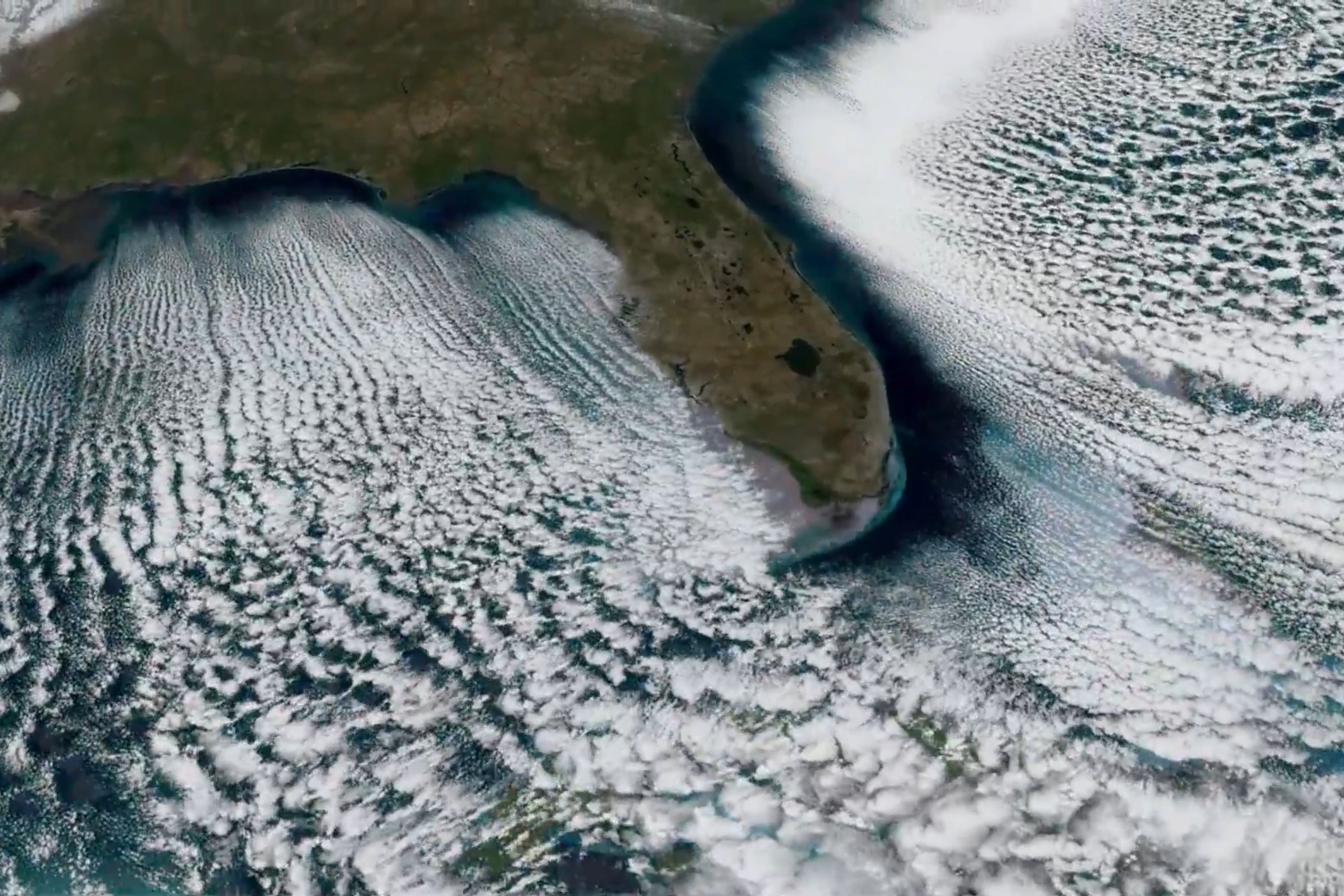
Satellite images from the National Oceanic and Atmospheric Administration (NOAA) captured "cloud streets" over the Gulf of Mexico and the Atlantic Ocean during an Arctic cold wave in Florida. This weather event brought record low temperatures to several cities in Florida, with some areas experiencing rare snow flurries.Key Facts
- NOAA's satellite captured cloud formations called "cloud streets" during a cold spell in Florida.
- The Arctic cold front set new temperature records across many cities in Florida.
- Daytona Beach, Leesburg, Sanford, and Orlando experienced temperatures as low as 23 degrees Fahrenheit.
- Tampa experienced snow flurries, which is uncommon for the area.
- "Cloud streets" form when cold, dry air moves over warmer water, creating parallel bands of clouds.
- NOAA uses its GOES East satellite to provide detailed images for monitoring severe weather.
- The cold conditions in Florida were colder than those usually seen in Montana during winter.
- A forecast suggests warmer temperatures are expected in parts of the U.S. later in February.
Read the Full Article
This is a fact-based summary from The Actual News. Click below to read the complete story directly from the original source.