Arctic Blast Maps Show States Facing Snow as Travel Warning Issued
Summary
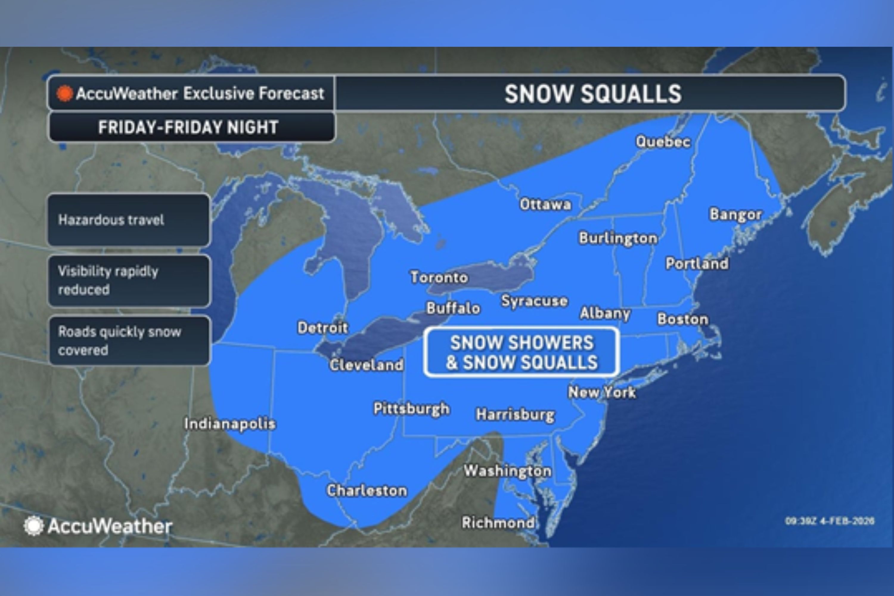
An Arctic air mass is expected to hit the northeastern United States, bringing snow, strong winds, and very cold temperatures. The weather conditions could make travel difficult and increase energy needs. The cold air is a result of a weather pattern involving the polar vortex.Key Facts
- An Arctic front will move from the Great Lakes to the Northeast and New England from Friday to Saturday.
- Snow squalls and strong winds are expected, potentially affecting travel and infrastructure.
- Winds could reach speeds of 50-55 mph in parts of the Northeast and New England.
- Friday evening commutes may be particularly affected due to sudden weather changes.
- The Weather Prediction Center warns of extremely cold temperatures and dangerous wind chills.
- The cold conditions are part of a pattern involving the polar vortex, which can bring Arctic air southward in winter.
- The polar vortex is a large area of low pressure and cold air near Earth's poles.
Read the Full Article
This is a fact-based summary from The Actual News. Click below to read the complete story directly from the original source.