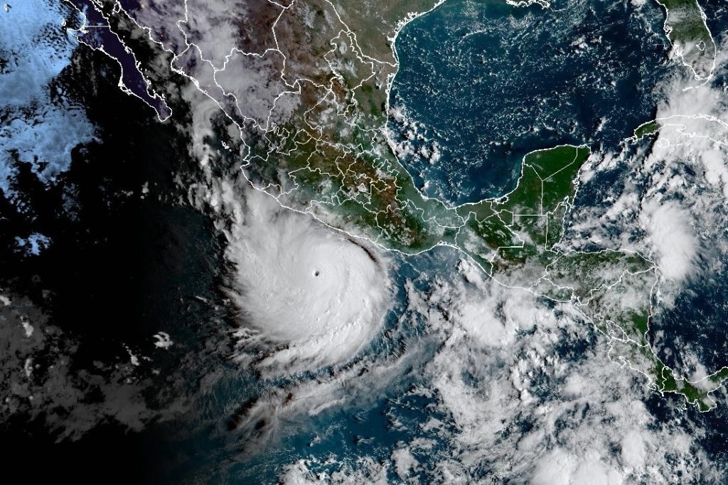
Live Map: Track the path of Hurricane Polo
Summary
Hurricane Polo became a very strong Category 5 storm in the eastern Pacific near southwestern Mexico. It is expected to stay mostly offshore while bringing heavy rain and possible flooding to parts of coastal Mexico.Key Facts
- Hurricane Polo reached Category 5 with winds of 160 mph (257 kph).
- It was located about 360 miles south-southeast of Manzanillo, Mexico.
- The storm is moving east at 6 mph but is forecast to turn northwest and stay near the coast.
- A tropical storm watch is in effect from south of Manzanillo to Tecpan de Galeana.
- Polo could cause heavy rain, flooding, and landslides in Guerrero and Michoacán states.
- Smaller rain amounts are expected in Oaxaca, Colima, and Jalisco states.
- Category 5 means the storm has sustained winds over 157 mph on the Saffir-Simpson scale.
- Another Pacific storm, Tropical Storm Odalys, may strengthen into a hurricane soon.
Read the Full Article
This is a fact-based summary from The Actual News. Click below to read the complete story directly from the original source.