Trump Shares Map of US Including Greenland, Canada, Venezuela
Summary
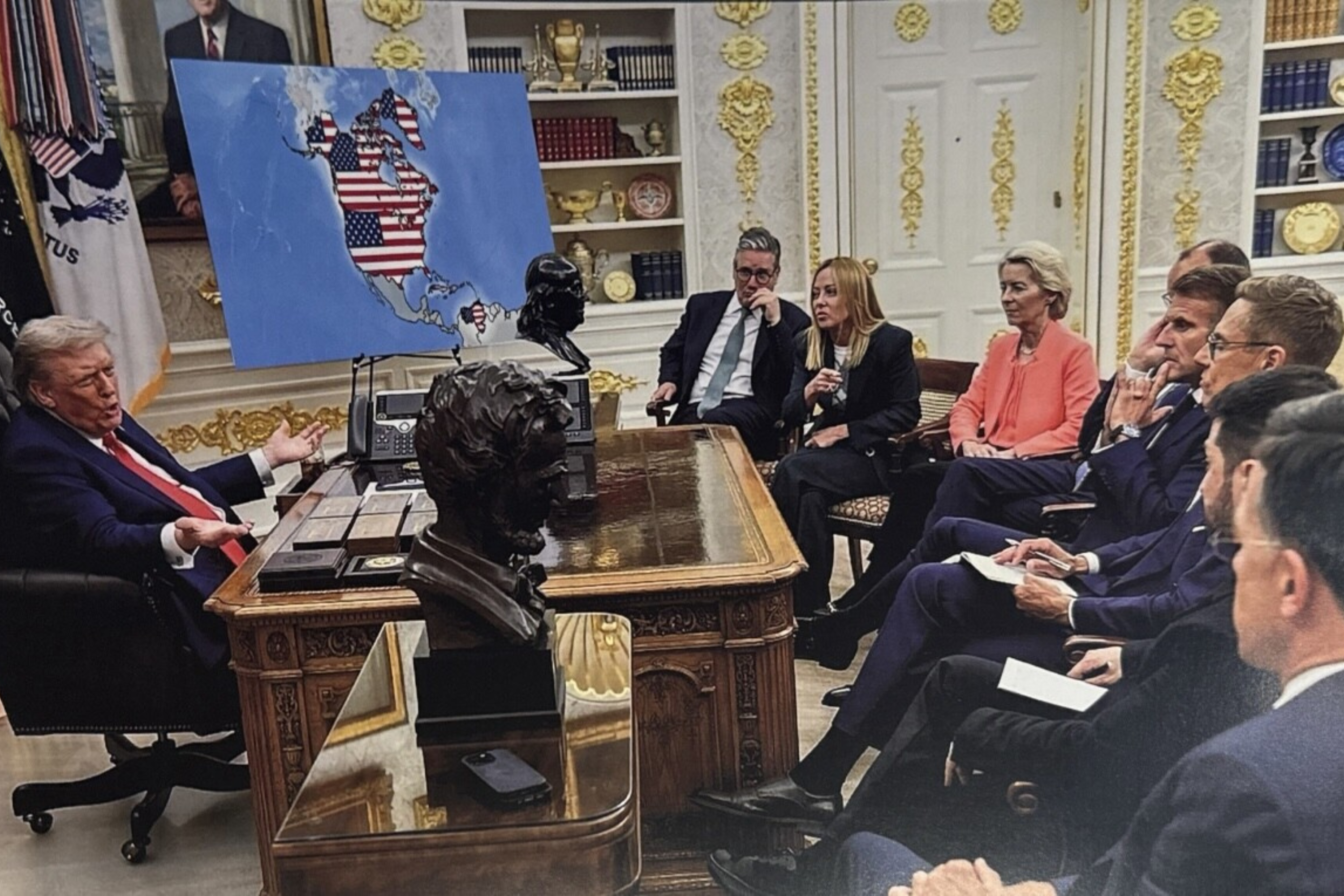
President Donald Trump shared an edited image showing a map of the United States that includes Greenland, Canada, and Venezuela. This image, along with another showing Trump in Greenland claiming it as a U.S. territory, highlights his interest in acquiring Greenland for national security reasons. The images were posted on Truth Social, and discussions about acquiring Greenland have been ongoing.Key Facts
- President Donald Trump shared an AI-edited image with an altered map of the U.S.
- The map includes Greenland, Canada, and Venezuela as part of the United States.
- The image shows Trump talking to European leaders, including French President Emmanuel Macron.
- Another AI-created image shows Trump in Greenland with an American flag, claiming it as a U.S. territory.
- Trump has expressed interest in acquiring Greenland, citing national security reasons.
- Trump has not ruled out military action if Denmark does not agree to sell Greenland.
- The images were posted on Truth Social, a social media platform.
- The story is developing, and updates are expected.
Read the Full Article
This is a fact-based summary from The Actual News. Click below to read the complete story directly from the original source.